
Tour des Fiz
About Tour des Fiz
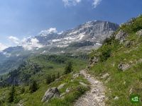
A hut-to-hut circuit around the limestone walls of the Chaîne des Fiz, above Passy in Haute-Savoie and facing Mont Blanc. It skirts the Désert de Platé, drops past the waterfalls of the Sales valley and climbs to Lac d'Anterne before returning through high pastures.
Tour des Fiz map
The interactive map shows the whole route, with accommodation, water and public transport along the way.
Tour des Fiz route planner
Build a day-by-day itinerary in the route planner, find accommodations along the route, and download the GPX file.
Open the Tour des Fiz route plannerBest time to go
- Best time1 Jul – 15 Sept
- Possible, with care16 Jun – 30 Jun, 16 Sept – 30 Sept
Walkable from mid-June to late September; before then Passy's tourist office strongly advises against starting, as sections may be unmarked or unequipped. Lingering snow can make some cols dangerous into early July, even impassable without crampons and an ice axe. Every refuge is open from July to mid-September, busiest from mid-July to mid-August. They then close one by one, the last between 18 and 23 September, and the loop has no valley beds.
Frequently asked questions
When can you walk the Tour des Fiz, and when do the refuges open and close?
From the middle of June to the end of September, which is the window the Passy tourist office gives. Late snow can push the start back. The office warns that early in the season lingering snow can make some cols dangerous, even impassable without crampons and an ice axe, and it strongly advises against starting before mid-June at all. Within that window the refuges set the limits. In 2026 the five on the main loop opened between 30 May and 13 June. They closed in turn: Platé on 12 September, the Châtelet d'Ayères on the 13th, Alfred Wills on the 18th, Sales on the 20th and Moëde Anterne on the 23rd. So the three-day plan, with nights at Sales and Alfred Wills, only works until about the middle of September, and after the 23rd none of them is staffed. Mid-July to mid-August is the busiest period, while June and September are quieter. The dates move every year, so check each refuge's own page before you fix yours.
How many days do you need for the Tour des Fiz, and can you do it in 2, 3 or 4 days?
Three days is the standard. The Passy tourist office presents its three-day plan, L'Incontournable, as the ideal first multi-day hike: nights at Sales and Alfred Wills, with walking times of about 5h40, 2h30 and 5h. Fit walkers can do the same loop in two days, either with a short first day to Sales and a second day of about 7h30, or with a long first day of about 8h to Alfred Wills. For four days, the office adds a night at the Refuge des Fonts by going round through Les Fonts between Sales and Alfred Wills, and it also lists a gentler five-day family version. Every plan starts and finishes at Plaine-Joux above Passy, which the Y85 bus reaches from Sallanches. The Trail du Tour des Fiz is something else, a yearly trail race whose main course, the Tour des 5 Refuges, follows a longer line than the walkers' loop.
How hard is the Tour des Fiz, and can you avoid the Passage du Dérochoir?
The main loop is a moderate hut walk that needs no technical gear, and yes, it avoids the Passage du Dérochoir altogether. The Dérochoir is an old rockfall climbed on cables, steps and ladders. The Passy tourist office calls it semi-climbing and advises it for the ascent only. Haute-Savoie Tourisme lists it as open from 15 June to 6 November, and a municipal order closes the path outside those dates. The main loop still has delicate ground of its own. The steep first climb from Plaine-Joux to Platé goes up the Égratz, also called the cheminée de Platé, a narrow, steep path that Haute-Savoie Tourisme flags as a delicate passage. On the last day the Argentières path between Moëde Anterne and Lac de Pormenaz has some handrails. If that worries you, the office suggests the 4x4 track down to Ayères des Pierrières instead; the Chorde path, the third option, adds many ladders. In the Traileasy planner the Dérochoir, the Chorde path and the Ayères track are each a separate variant, so you can plan your days on the line you are comfortable with.
Do you need to book the refuges on the Tour des Fiz, and how?
Yes. The Passy tourist office says booking refuge nights ahead is essential, and its planning blog suggests up to six months ahead if you are going between mid-July and mid-August. How you book depends on the refuge. Alfred Wills, Moëde Anterne and the Châtelet d'Ayères take online bookings on Mon refuge au Pays du Mont-Blanc, at monrefugepaysdumontblanc.com. Sales cannot be booked online, so you phone the refuge. Platé is a French Alpine Club (FFCAM) refuge, booked through its FFCAM page or by phone. All five work on half board, with dinner, a bed and breakfast. Bring a sleeping-bag liner.
Can you bivouac on the Tour des Fiz, and where is it not allowed?
Yes, but only from 7pm to 9am, and the rules differ between the two nature reserves the loop crosses. The Passy tourist office tolerates bivouac in those hours, but not at Lac Vert or around the Châtelet d'Ayères refuge. It points you instead to the camping area at Plaine-Joux, or to ground higher up from Lac de Pormenaz. In both reserves you pitch after 7pm, take the tent down by 9am and never stay several nights in one place, and fires are banned. In the Passy reserve, around Moëde Anterne and Lac de Pormenaz, that is all. The Sixt-Fer-à-Cheval/Passy reserve, which takes in the Sales valley and Lac d'Anterne, is stricter. Asters, the conservation body that manages it, marks bivouac there as discouraged outside a few tolerated zones, and asks walkers to book a spot in those zones, free, on reserve-bivouac74.fr from June to September. Its site warns of a 68 euro fine for a tent outside the zones or the hours. For water, the office lists water points at Sales, Alfred Wills and Moëde Anterne on the main loop, and none is guaranteed in a drought.
Can you bring a dog on the Tour des Fiz, and can you swim in the lakes?
No to both. Dogs are banned in the Passy and Sixt-Fer-à-Cheval nature reserves, even on a lead, and the loop runs through both, so the tourist office lists the Tour des Fiz as closed to dogs. Only working sheepdogs and rescue dogs are allowed, because other dogs disturb ground-nesting birds, wild animals and livestock. Some refuges, Platé and the Châtelet d'Ayères among them, refuse dogs as well. Swimming is banned in every lake you pass, however hot the day, and so are washing and doing dishes in them, even with biodegradable soap. On the pastures some flocks are guarded by protection dogs: keep your distance, avoid sudden movements and walk on without running.
Where can you get a map or GPX of the Tour des Fiz, and is the route waymarked?
The Passy tourist office gives a free GPX track and a PDF map with each of its Tour des Fiz itineraries. Its free topo brochure shows every route and refuge on one map. The route is waymarked, and the reserves ask you to stay on the marked paths. Before mid-June, though, the office warns that some sections may still be unmarked or without their fixed equipment. The Traileasy app follows the route you planned and works offline, so you can find your way each day without a phone signal. For a GPS watch, export the itinerary you built in the planner as a GPX file.