
Thames Path
About Thames Path
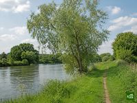
The Thames Path follows England's greatest river from the Thames Barrier at Woolwich upstream to a quiet meadow in the Cotswolds where it rises. It leaves the bridges and wharves of London for locks, weirs and towpaths, passing Windsor, Henley and Oxford before the river narrows to a stream.
Thames Path map
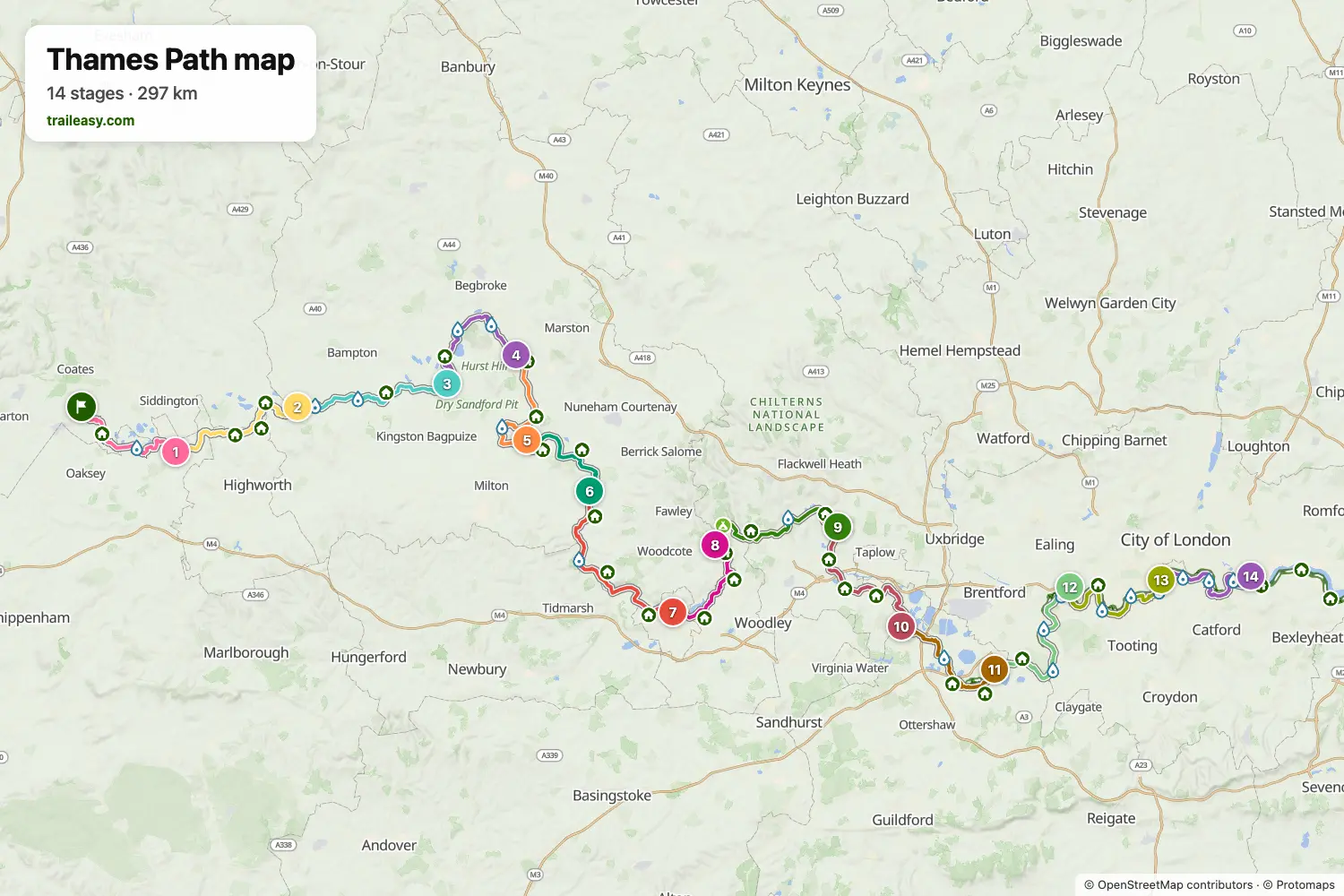
The interactive map shows the whole route, with accommodation, water and public transport along the way.
Thames Path route planner
Build a day-by-day itinerary in the route planner, find accommodations along the route, and download the GPX file. Start from an example below or from scratch.
14-Day ItineraryShown below
A river walk from source to sea, following the Thames from a quiet meadow spring in the Cotswolds all the way through London to the Thames Barrier. The upper river is pastoral and largely empty — water meadows, weirs and stone villages — before Oxford, Henley and Windsor bring locks, boathouses and grand riverside estates, and the final days turn the towpath into a walk through the heart of the capital. It is flat throughout and never far from a station.
Thames Path stages
14 days, 318 km and 378 m of ascent. These stages follow the 14-Day Itinerary. Open it in the route planner to split or merge days and choose where you sleep.
- Stage 119.6 km↑ 12 m · ↓ 36 m ·
5–6h with stopsTo Cricklade
Night at The Red Lion Cricklade - Stage 223.5 km↑ 14 m · ↓ 30 m ·
6–7h with stopsCricklade Lechlade
Night at The Plough Inn - Stage 326.4 km↑ 6 m · ↓ 14 m ·
7–8h with stopsLechlade Newbridge
Night at Barefoot Campsites - Stage 420.8 km↑ 0 m · ↓ 8 m ·
5–6h with stopsNewbridge Oxford
Night at The Head of the River, Oxford - Stage 523.1 km↑ 13 m · ↓ 13 m ·
6–7h with stopsOxford Culham
Night at The Railway Inn - Stage 616.7 km↑ 8 m · ↓ 19 m ·
4–5h with stopsCulham Wallingford
Night at The Coachmakers Arms - Stage 728.0 km↑ 129 m · ↓ 140 m ·
8–9h with stopsWallingford Reading
Night at Village Hotel Reading - Stage 817.5 km↑ 8 m · ↓ 12 m ·
4–5h with stopsReading Henley-on-Thames
Night at The Bull on Bell St - Stage 924.6 km↑ 83 m · ↓ 37 m ·
7–8h with stopsHenley-on-Thames Cookham
Night at Cliveden House - Stage 1027.0 km↑ 32 m · ↓ 86 m ·
7–8h with stopsCookham Old Windsor
Night at De Vere Beaumont Estate - Stage 1120.2 km↑ 4 m · ↓ 22 m ·
5–6h with stopsOld Windsor Walton-on-Thames
Night at Weir Hotel - Stage 1223.9 km↑ 17 m · ↓ 15 m ·
6–7h with stopsWalton-on-Thames Chiswick
Night at Clayton Hotel Chiswick - Stage 1322.1 km↑ 33 m · ↓ 37 m ·
6–7h with stopsChiswick Westminster
Night at Park Plaza London Westminster Bridge - Stage 1424.5 km↑ 19 m · ↓ 19 m ·
6–7h with stopsWestminster Woolwich
Best time to go
- Best time1 May – 30 Jun, 1 Sept – 30 Sept
- Good time1 Apr – 30 Apr, 1 Jul – 31 Aug, 1 Oct – 31 Oct
- Possible, with care1 Nov – 31 Mar
May, June and September are the best months, with firm towpath, long days and the riverside pubs open. July and August work well, though the towpath through the Home Counties fills with cyclists and day walkers at weekends. From November to March the upper river west of Oxford floods regularly and the path can sit under water or be officially closed for weeks.
Frequently asked questions
How long does it take to walk the Thames Path?
Most people take between two and three weeks to walk the whole trail from the source to the Thames Barrier. Guidebooks usually split it into around twenty stages, which works out at a comfortable day's walking each, and the Thames Path is the flattest of the National Trails, so you can cover more ground per day than on a hill route without feeling it. Fit walkers who are happy with longer days finish in about a fortnight. There is no need to do it in one go, though, and a lot of people walk it in weekends across a season since so much of the route has a station within reach. Allow extra time in the upper reaches, where the going is slower and the villages sit further apart than the map suggests.
Where does the Thames Path start and end, and which direction should you walk it?
The official trail runs between Thames Head, a field near Kemble in Gloucestershire marked by a stone, and the Thames Barrier at Woolwich in south east London. The source itself is usually dry, so the first water you actually see is some way downstream, which catches out people expecting a spring. At the eastern end the trail was extended past the Barrier out to Crayford Ness, where the river Darent joins the Thames, so you can choose whether to finish at the Barrier or carry on into the estuary. Source to sea is the more popular direction and the one the National Trail describes, since walking downstream means the river grows beside you from a ditch into a tidal waterway, the prevailing wind is usually behind you, and you finish in London where getting home is straightforward. Going the other way, from the Barrier upstream, gets the city out of the way first and ends in quiet countryside, which suits people who would rather finish somewhere peaceful. Neither direction is harder, since there is almost no climbing to speak of, and the waymarking works both ways, so the choice is about how you want the walk to feel rather than about navigation.
Which bank of the Thames should you follow through London?
Both banks are official between Teddington footbridge and Island Gardens, so this is a real choice rather than a shortcut. The south bank is the shorter of the two and takes you past Richmond, Kew Gardens, Battersea, the South Bank and on to Greenwich. The north bank runs through Chiswick and Hammersmith, then along the Embankment past Westminster and the Tower before Wapping and Limehouse, and it carries more of the famous views at the cost of more pavement. Eight bridges link the two sides inside that stretch, so you can start on one bank and swap partway if you change your mind. On Traileasy the north bank is stored as a selectable route variant, so you can switch it on and see how it reshapes your daily stages before booking anything.
What is the best section of the Thames Path to walk?
For quiet countryside, the upper river between Cricklade and Oxford is the strongest part of the trail, with water meadows, small locks and villages that barely register from the road. For a first taste, the stretch from Oxford down through Abingdon and Wallingford is easy to reach and easy to walk in a few days. For landmarks, the central London section is unbeatable, packing Westminster, the South Bank, Tower Bridge and Greenwich into a single day. The least rewarding parts are the outer suburbs either side of the capital, where the path spends a while behind fences and industrial estates. If you only have a long weekend, pick a section with a station at both ends and walk it downstream.
When is the best time of year to walk the Thames Path?
May, June and September. The thing worth understanding about the Thames Path is that flooding runs on a lag, so a clear forecast tells you very little: the upper river west of Oxford can still be spilling across the meadows days after the rain that caused it has passed. The Environment Agency publishes river levels and the National Trail publishes closures and diversions, and between them they answer the question a weather app cannot. Check both a few days out in any wet spell, and again the night before if the level is rising. Through the summer the towpath itself is the constraint rather than the water, since the Home Counties stretches fill with cyclists and day walkers at weekends.
Do you need to book accommodation on the Thames Path in advance?
It depends entirely on which part of the trail you are on, which is what catches people out. Between London and Oxford there is plenty of choice and a week or two of notice is often enough, but the upper river above Lechlade has very few beds and the ones that exist fill early, especially at weekends. The nights around Cricklade and Lechlade are the ones to lock in first, since walking past them to the next option makes for a very long day. Riverside pubs with rooms also close midweek out of season, so check they are actually open rather than assuming. Building the route in the Traileasy planner shows which villages your nights land in before you commit to a schedule, so you can shift a stage instead of discovering the gap on the day.