
Prättigauer Höhenweg
About Prättigauer Höhenweg
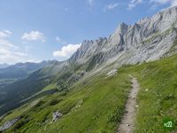
A high route along the upper slopes of the Prättigau in Graubünden, from the Rhine valley at Landquart to Klosters beneath the limestone walls of the Rätikon. It strings together the Schesaplana and Carschina huts, the Partnunsee and the Walser village of St. Antönien, with alpine pastures and long views across the valley.
Prättigauer Höhenweg map
The interactive map shows the whole route, with accommodation, water and public transport along the way.
Prättigauer Höhenweg route planner
Build a day-by-day itinerary in the route planner, find accommodations along the route, and download the GPX file. Start from an example below or from scratch.
4-Day ItineraryShown below
SchweizMobil's route 72 from Landquart to Klosters in four evenly matched days. Day one climbs through the vineyards of Malans to Seewis. Day two continues up to the Schesaplanahütte below the Rätikon walls. Day three crosses below the Rätikon to the Carschinahütte for lunch and drops down to St. Antönien, and the last day crosses over to Klosters.
Prättigauer Höhenweg stages
4 days, 77 km and 3,916 m of ascent. These stages follow the 4-Day Itinerary. Open it in the route planner to split or merge days and choose where you sleep.
- Stage 111.7 km↑ 712 m · ↓ 281 m ·
4–5h with stopsTo Seewis
Night at Hotel Scesaplana - Stage 216.2 km↑ 1,142 m · ↓ 187 m ·
6–7h with stopsSeewis the Schesaplanahütte
Night at Schesaplanahütte - Stage 325.6 km↑ 837 m · ↓ 1,330 m ·
9–10h with stopsthe Schesaplanahütte St. Antönien
Night at Hotel Madrisajoch - Stage 423.0 km↑ 1,225 m · ↓ 1,446 m ·
9–10h with stopsSt. Antönien Klosters
Best time to go
- Best time1 Jul – 30 Sept
- Good time16 Jun – 30 Jun
- Possible, with care1 Jun – 15 Jun, 1 Oct – 15 Oct
Walkable from early June to the middle of October, while the Schesaplanahütte and the Carschinahütte are open, with July to September the best time. In 2026 both huts opened in the first week of June and closed on 11 October, and the dates move by about a week between years. Snowfields can still lie on the high sections in June. The Carschinahütte has had no winter room since its 2025 renovation, so it offers no bed once it closes.
Frequently asked questions
Does the Prättigauer Höhenweg start in Landquart or Klosters, and which way round should you walk it?
Either way works. Traileasy follows SchweizMobil's route 72, which runs from Landquart by the Schesaplanahütte, the Carschinahütte and St. Antönien to Klosters. Walk it that way if you would rather climb than descend. The big climb out of the Rhine valley to the Schesaplanahütte comes on the first day, and at the far end the Madrisabahn spares you the last descent into Klosters. Prättigau Marketing sells its tours the other way round, starting with the Madrisabahn from Klosters up to the Saaser Alp, and says the route can be walked in either direction. Both ends are on the Rhaetian Railway, so a car can stay at Landquart station while you take the train back from Klosters at the end.
How many days does the Prättigauer Höhenweg take, and can you do it in three?
Four days, with nights in St. Antönien, at the Carschinahütte and at the Schesaplanahütte. SchweizMobil's route 72 and Prättigau Marketing's four-day tour both split it that way. The tour is the shorter of the two: it rides the Madrisabahn between Klosters and the Saaser Alp, and between Seewis and Landquart it takes a shorter way than route 72 by the Fadärastein and Malans. Three days works too. Prättigau Marketing's three-day tour goes from Klosters by St. Antönien to the Carschinahütte, then on the third day crosses the Fadurer Fürggli to the top station of the Fanas cable car, which takes you down to Fanas. That leaves out the Schesaplanahütte and the long stretch at the Landquart end.
When is the best time to walk the Prättigauer Höhenweg, and is there still snow in June?
July to September. The walking season runs from early June to the middle of October, while the two huts are open: in 2026 the Carschinahütte opened on 4 June and the Schesaplanahütte on 5 June, and both closed on 11 October. There can be snow in June. Graubünden Tourism's stage description warns that snowfields are possible on the high sections into the summer months, so check conditions with the huts before you set out. The dates also move by about a week from year to year. For 2027 the Carschinahütte gives 11 June to 17 October, provisionally, so for a trip in the first half of June or in October confirm both huts' dates first. Once the Carschinahütte has closed you cannot sleep there at all, since it no longer has a winter room.
How do you book the Schesaplanahütte and the Carschinahütte, and does the Carschinahütte still have a winter room?
Both huts book online through the SAC's hut reservation system, which each hut's website links to. At the Schesaplanahütte online bookings close at 18:00 the day before arrival, and later ones go by phone to the hut. The Carschinahütte requires a reservation in advance and opens the system for summer 2027 around the end of November or early December. It no longer has a winter room. That went in the 2025 renovation, before the hut reopened in June 2026, so outside the summer season there is no way to stay the night. The Schesaplanahütte still keeps a self-catering winter room, and you have to register before using it. Dogs are welcome at the Carschinahütte but not in the rooms, with a dog box in the basement if you arrange it ahead. At the Schesaplanahütte dogs must be on a lead. Out on the route, several alp pastures in the Rätikon are guarded by livestock guardian dogs.
How hard is the Prättigauer Höhenweg, and can you walk it with children?
It is a moderate mountain walk. The official tour pages grade the four-day tour T2 on the SAC hiking scale and the three-day tour to Fanas T2 to T3, and the three-day page recommends trekking shoes and basic navigation skills. The length of the stages asks more of you than the ground does. On the line of SchweizMobil's route 72, Graubünden Tourism times the stage between the Rhine valley and the Schesaplanahütte at about nine and a half hours, and the one between St. Antönien and Klosters at just over eight. From hut to hut it is about five. Children can do it. Prättigau Marketing promotes the tour for families, with reduced package prices for children, and asks you to weigh the dormitory nights in the huts and the stage lengths. With a family, the Madrisabahn shortens the Klosters stage and the three-day line to the Fanas cable car leaves out the Landquart stage altogether.
Is the Prättigauer Höhenweg closed because of the Madrisa Solar construction?
No. Only a short stretch above Klosters is closed, and a signed detour takes you round it. On the federal geoportal, the hiking closures layer Sperrungen Wanderwege lists the section Madrisa - Zügenhüttli as closed with a detour, until further notice, because of the construction work on Madrisa Solar. The entry comes from the Swiss Hiking Federation and the cantonal hiking associations. Davos Klosters gives the construction period for the alpine solar plant in the Züg area of the Madrisa as 2025 to 2027. The detour adds only a little distance and climbing. The closure has no fixed end date, so check the layer or Davos Klosters' live trail status before you go. In Traileasy the main line stays on the permanent path, and the signed detour is the variant Umleitung Madrisa Solar, which you can swap into your plan while the works last.