
Liechtenstein Trail
Also known as Liechtenstein-Weg
About Liechtenstein Trail
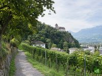
The Liechtenstein Trail, known locally as the Liechtenstein-Weg, crosses the whole principality from the Swiss border at Balzers to the Austrian border at Schaanwald. It passes through all eleven municipalities, from Gutenberg Castle and the Walser village of Triesenberg to the capital Vaduz and the Ruggeller Riet nature reserve.
Liechtenstein Trail map
The interactive map shows the whole route, with accommodation, water and public transport along the way.
Liechtenstein Trail route planner
Build a day-by-day itinerary in the route planner, find accommodations along the route, and download the GPX file. Start from an example below or from scratch.
5-Day ItineraryShown below
The Liechtenstein Trail in its five official stages, from the boundary stone on the Swiss border at Balzers to the customs post at Schaanwald on the Austrian border. The first day climbs from Balzers through Triesen to the Walser village of Triesenberg, the biggest climb of the trip, and the second drops back down to the capital, Vaduz. The middle days follow the slopes of the Rhine valley through Schaan and Planken to Nendeln, then cross the valley floor by Eschen and Bendern to Ruggell. The last day leads through the Ruggeller Riet nature reserve and up to Schellenberg before the Austrian border. Every night is in a village hotel, and every stage ends near a bus stop.
Liechtenstein Trail stages
5 days, 71 km and 2,135 m of ascent. These stages follow the 5-Day Itinerary. Open it in the route planner to split or merge days and choose where you sleep.
- Stage 113.0 km↑ 571 m · ↓ 167 m ·
4–5h with stopsTo Triesenberg
Night at Hotel Kulm - Stage 29.7 km↑ 280 m · ↓ 702 m ·
3–4h with stopsTriesenberg Vaduz
Night at Hotel Residence - Stage 313.8 km↑ 526 m · ↓ 532 m ·
5–6h with stopsVaduz Nendeln
Night at Hotel Restaurant Weinstube - Stage 414.9 km↑ 280 m · ↓ 299 m ·
4–5h with stopsNendeln Ruggell
Night at Landgasthof Rössle - Stage 519.1 km↑ 478 m · ↓ 431 m ·
6–7h with stopsRuggell Schaanwald
Best time to go
- Best time1 Apr – 30 Jun, 1 Sept – 31 Oct
- Good time1 Mar – 31 Mar, 1 Jul – 31 Aug, 1 Nov – 30 Nov
- Possible, with care1 Dec – 29 Feb
Walkable all year, on a low route with a bus stop at the end of every stage. April to June and September to October are the best months, mild, with more daylight in spring. July and August are the warmest and wettest months, with the most thunderstorms. From December to February the steep sections at Triesenberg and Planken are for dry, snow-free days only, with the valley floor or the bus as the way round; March and November can bring snow there too.
Frequently asked questions
How long does it take to walk the Liechtenstein Trail, and can you do it in 3 days?
Most people take four or five days. The official route has five stages of three to five and a half hours each, about 21 hours of walking in all from the Swiss border to the Austrian one. Three days works if you are fit. Join the first two stages into one day from Balzers over Triesenberg to Vaduz, walk from Vaduz to Ruggell on the second, and keep the official last stage to Schaanwald for the third. That gives two days of around eight hours, with the biggest climb of the trail on the first. Every stage ends at a bus stop, so a day that runs long can be cut short and picked up the next morning. The loop along the Rhine at Vaduz is no longer part of the official stages. Add it in the Traileasy planner, where it is an optional variant, and the planner shows how much longer that makes the day at Vaduz.
How difficult is the Liechtenstein Trail, and how much of it is paved?
The walking is moderate and never technical, and a little over half of the route is paved. Going by the surface data in OpenStreetMap, about 56 percent of the route runs on hard surfaces, nearly all of it asphalt. Those stretches sit in and between the villages: around Balzers, from Vaduz to Schaan, and from Nendeln to Bendern. The descent from Triesenberg to Vaduz and the first half of the last stage, through the Ruggeller Riet and up to Schellenberg, are almost all natural paths. The hard parts are short and steep. The climb from Triesen to Triesenberg, the drop to Vaduz and the hillside at Planken all turn slippery after rain. Signposting is the other thing to plan for: the blue and red signs stand mainly where the route changes direction, and walkers keep reporting gaps, so carry the route on a map as well.
Is the Liechtenstein Trail the same as the Liechtenstein Panorama Trail (Route 66)?
No, they are two separate routes. The Liechtenstein Trail is the low one. It runs the length of the country from the Swiss border at Balzers to the Austrian border at Schaanwald, passing through all eleven municipalities along the Rhine valley and its lower slopes. The Liechtenstein Panorama Trail, signposted as route 66 and called the Liechtensteiner Panoramaweg in German, is a three-stage mountain route from Malbun along the alpine ridge to Ruggell. It asks for sure footing, a head for heights and mountain experience, and it relies on mountain huts and the summer season. If a description mentions huts, Malbun or the Fürstensteig, it is about the Panorama Trail.
Is any part of the Liechtenstein Trail closed?
Yes, one section of the last stage. The stretch between Kesse and Rennhof, in the Schellenberg and Mauren area, is expected to stay closed until the middle or end of 2027. Liechtenstein Marketing, which maintains the trail, announces this on its page for stage five and has drawn a diversion along roads on the map there. Its instruction is to follow the line on the map through this section, not the signposts. In November 2026 the warning stood on the German version of that page only, so it is easy to miss in English. The end date is an estimate, so read the stage page again shortly before you go. The route in the Traileasy app already follows the diversion, so the line on the offline map is the one to walk.
Where do you stay on the Liechtenstein Trail, and is there luggage transfer?
You sleep in hotels and guesthouses in the villages, and yes, your bag can be moved for you. Vaduz and Schaan have the widest choice of rooms. Not every village on the route has somewhere to stay, which matters less than it sounds. Every stage starts and ends at a bus stop, so it works well to keep one base in Vaduz or Schaan and take the bus out and back each day. Luggage transfer comes with the walking packages sold by Liechtenstein Marketing and by tour operators. The usual terms are one bag per person of up to 20 kg, carried to the next hotel each day, along with a pass that covers the buses. If you book your own rooms, ask the tourist office whether bags can be carried between them.
How do you get to the start of the Liechtenstein Trail and back from the end?
By train to a station just across the border, then by bus. One bus line serves both ends of the trail. Liechtenstein has no airport and no station where long-distance trains stop. For the start, take the train to Sargans in Switzerland, about an hour from Zurich, and then bus 11 to the stop Balzers Höfle. The trail begins at a boundary stone on the Swiss border, roughly a quarter of an hour on foot from there. It ends at the Schaanwald customs post on the Austrian border, right by the stop Schaanwald Zollamt. From there bus 11 continues to Feldkirch station in Austria, a short ride, or runs back through the whole country to Sargans. Timetables change each December, so check the LIEmobil journey planner before you travel.
Can you walk the Liechtenstein Trail in winter?
Usually, yes. The route stays low, with its highest point on the hillside between Triesenberg and Vaduz, and Liechtenstein Marketing says the whole trail can usually be walked through the winter months. Three steep sections are the exception. Triesen up to Triesenberg, Triesenberg down to Vaduz and the stretch to Planken should only be walked when they are dry and free of snow. For those days the tourist board points to flat alternatives across the valley floor, from Triesen to Vaduz and from Schaan to Nendeln, and the buses cover the same gaps. The slopes around Eschen and Schellenberg get slippery in snow as well.