
Gudbrandsdalsleden
Also known as Olavsweg, St. Olav Way, or Pilegrimsleden
About Gudbrandsdalsleden
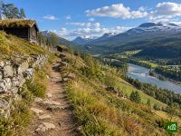
The pilgrim road to Nidaros, walked from the old cathedral ruins in Oslo to the shrine of Saint Olav in Trondheim. It climbs out of the capital into forest and farmland, follows the long green valley of the Gudbrandsdal, then crosses the high tundra of Dovrefjell before dropping to the fjord and the cathedral that has drawn pilgrims for a thousand years.
Gudbrandsdalsleden map
The interactive map shows the whole route, with accommodation, water and public transport along the way.
Gudbrandsdalsleden route planner
Build a day-by-day itinerary in the route planner, find accommodations along the route, and download the GPX file. Start from an example below or from scratch.
32-Day ItineraryShown below
The whole west arm of the pilgrim road to Nidaros, walked from Oslo to the cathedral in Trondheim. It leaves the capital through the forests of Bærum and down to Sundvollen, crosses Hadeland and the farmland of Toten to Gjøvik on Lake Mjøsa, then follows the Gudbrandsdal north through Lillehammer, Ringebu and Otta. Beyond Dovre it climbs onto Dovrefjell by Kongsvoll and the refuge at Ryphusan, drops down Drivdalen to Oppdal on the old royal road over Dovre, and runs through Rennebu and the Orkla valley to Skaun, the fjord at Buvika and Nidarosdomen. Nights are in pilgrim hostels, farms and old mountain inns, most of them on the pilgrim centre's own register, with hotels in the towns.
Gudbrandsdalsleden stages
32 days, 730 km and 17,892 m of ascent. These stages follow the 32-Day Itinerary. Open it in the route planner to split or merge days and choose where you sleep.
- Stage 122.5 km↑ 542 m · ↓ 380 m ·
7–8h with stopsTo Haslum
Night at Gardlaus Markastue og Pilegrimsherberge - Stage 225.4 km↑ 675 m · ↓ 767 m ·
8–9h with stopsHaslum Sundvollen
Night at Sundvolden Hotel - Stage 339.2 km↑ 692 m · ↓ 533 m ·
12–13h with stopsSundvollen Hønefoss
Night at Klækken Hotel - Stage 427.3 km↑ 832 m · ↓ 639 m ·
9–10h with stopsHønefoss Rudsødegården
Night at Rudsødegården - Stage 527.0 km↑ 846 m · ↓ 606 m ·
9–10h with stopsRudsødegården Høgkorset
Night at Høgkorsplassen pilgrim hostel - Stage 616.8 km↑ 293 m · ↓ 542 m ·
5–6h with stopsHøgkorset Kolbu
Night at Engen kloster i Kolbu - Stage 719.8 km↑ 299 m · ↓ 453 m ·
6–7h with stopsKolbu Lena
Night at Hoffsvangen Bygdestue - Stage 817.0 km↑ 254 m · ↓ 308 m ·
5–6h with stopsLena Annexstad
Night at Annexstad Farm - Stage 923.9 km↑ 543 m · ↓ 626 m ·
8–9h with stopsAnnexstad Redalen
Night at Sveastranda Camping - Stage 1021.2 km↑ 457 m · ↓ 453 m ·
6–7h with stopsRedalen Biristrand
Night at Flutua Camping - Stage 1120.1 km↑ 509 m · ↓ 380 m ·
6–7h with stopsBiristrand Lillehammer
Night at Scandic Lillehammer Hotel - Stage 1240.2 km↑ 561 m · ↓ 542 m ·
12–13h with stopsLillehammer Hafjell
Night at Nermo Hotel Hafjell - Stage 1325.1 km↑ 1,081 m · ↓ 1,049 m ·
9–10h with stopsHafjell Tretten
Night at Mageli gard - Stage 1423.7 km↑ 649 m · ↓ 756 m ·
8–9h with stopsTretten Ringebu
Night at Jonsgård bed and breakfast B & B Britt Åse Høyesveen - Stage 1517.2 km↑ 405 m · ↓ 317 m ·
5–6h with stopsRingebu Harpefoss
Night at Sygard Grytting - gammel storgård og historisk hotell i Gudbrandsdalen - Stage 1623.6 km↑ 866 m · ↓ 904 m ·
8–9h with stopsHarpefoss Kvam
Night at Sinclair - Stage 1721.3 km↑ 843 m · ↓ 799 m ·
7–8h with stopsKvam Sjoa
Night at Sjoa Raftingsenter - Stage 1822.6 km↑ 326 m · ↓ 326 m ·
7–8h with stopsSjoa Nord-Sel
Night at Jørundgard Middelaldersenter - Stage 1927.0 km↑ 907 m · ↓ 570 m ·
9–10h with stopsNord-Sel Budsjord
Night at Budsjord Pilegrimsgården Hotel - Dovre - Stage 2025.5 km↑ 919 m · ↓ 616 m ·
9h with stopsBudsjord Vålåsjøen
Night at Dovregubbens Hall - Stage 2125.2 km↑ 647 m · ↓ 692 m ·
8–9h with stopsVålåsjøen Kongsvoll
Night at Kongsvoll - Stage 2221.7 km↑ 649 m · ↓ 449 m ·
7–8h with stopsKongsvoll Ryphusan
Night at Ryphusan Refugium - Stage 2328.6 km↑ 311 m · ↓ 861 m ·
9–10h with stopsRyphusan Oppdal
Night at Quality Hotel Skifer - Stage 2414.9 km↑ 269 m · ↓ 257 m ·
4–5h with stopsOppdal Fagerhaugen
Night at Oppdalsporten Veikro - Stage 2514.9 km↑ 260 m · ↓ 332 m ·
4–5h with stopsFagerhaugen Havdal
Night at Gjesteheim Havdal - Stage 2630.3 km↑ 920 m · ↓ 1,178 m ·
10–11h with stopsHavdal Voll
Night at Norway Voll - Stage 2725.1 km↑ 415 m · ↓ 501 m ·
8–9h with stopsVoll Meldal
Night at Ner-Grefstad Gard - Pilgrimsherberge - Stage 2820.4 km↑ 379 m · ↓ 350 m ·
6–7h with stopsMeldal Svorkmo
Night at Svorkmo skytterhus - Stage 2915.6 km↑ 453 m · ↓ 367 m ·
5–6h with stopsSvorkmo Aunan
Night at Aunan Gård - Stage 3014.0 km↑ 415 m · ↓ 475 m ·
4–5h with stopsAunan Buvika
Night at Kleivan pilgrim hostel - Stage 3114.2 km↑ 229 m · ↓ 333 m ·
4–5h with stopsBuvika Skjefstad
Night at Stabburet på Skjefstad - Stage 3218.6 km↑ 446 m · ↓ 524 m ·
6–7h with stopsSkjefstad Trondheim
Best time to go
- Best time16 Jun – 31 Aug
- Good time1 Jun – 15 Jun, 1 Sept – 15 Sept
- Possible, with care1 May – 31 May, 16 Sept – 30 Sept
Best from mid-June to the end of August, with the pilgrim hostels open and Dovrefjell passable. In May most hostels are still shut, and until mid-June snow lies on the plateau, its river bridges are not yet in place and the wild reindeer are calving, so a May start means slowing down or taking the train across. In September the hostels close one by one, and Ryphusan, the only bed on the route between Kongsvoll and Oppdal, closes in early October.
Frequently asked questions
When can you cross Dovrefjell on the Gudbrandsdalsleden?
Once the snow has gone, the river bridges are in place and the wild reindeer have finished calving. Dovrefjell is the only real mountain stretch on the route, open high ground between Dovre and Oppdal. Early in the summer the Hondyrju and Vesle Hondyrju rivers run with icy meltwater and cannot be waded, so the crossing waits until bridges are laid over them, and while snow lies it hides the waymarks and keeps the lodges on the plateau closed. Two stretches, Dovre to Fokstugu and Kongsvoll to Oppdal, also cross reindeer calving grounds that walkers are asked to keep off until calving is over. At a steady pace you reach the plateau about three weeks after leaving Oslo, so count back from there when you pick a start date. If snow is still lying when you arrive, the pilgrim centre's advice is to take the train across. Late in the season the limit is beds, not snow. Ryphusan, a small unstaffed refuge, is the only place between Kongsvoll and Oppdal that takes single walkers, and once it shuts that crossing becomes one very long day over the highest ground. The Dovrefjell pilgrim centre at Hjerkinn knows the current state of the snow and the bridges, and since its staff are often out on the trail, ring before you visit.
How long is the Gudbrandsdalsleden, and how many days does it take?
About a month on foot. The National Pilgrim Centre counts around 32 walking days for the whole walk from Oslo to Nidaros Cathedral and advises building in rest days, which makes four to five weeks a realistic plan. Both arms out of Oslo are roughly the same length, so choosing one does not change the total. You do not have to walk all of it. The last week or so from Berkåk to Trondheim is enough for the Olav Letter, and the Gudbrandsdal from Lillehammer to Dovre makes a trip of about a week and a half on its own. The Traileasy planner lays the walk out night by night, with each day's start and end chosen by you, so you can sketch the full five weeks from Oslo, a faster plan with fewer rest days or the Berkåk finish on its own, and weigh them against one another.
How hard is the Gudbrandsdalsleden, and can you walk it alone?
It is long rather than technical. The ground keeps changing, from field edges and meadows to steep slopes, tarmac and, on Dovrefjell, open moor, and for that mix of wet grass and warm tarmac the pilgrim centre suggests boots with good cushioning. Waymarking is good, though the centre still tells walkers to carry a map and compass. Its own yardstick is that you should be fit enough for a long walk and at ease in open country. Dovrefjell is the exposed part, and it can turn cold enough for a hat and gloves even in midsummer. Walking alone is considered safe. How much company you get depends on where you are. Of the roughly 18,000 paid pilgrim nights recorded along the route in 2025, about half fell between Dovrefjell and Trondheim, while the regions along each of the two arms south of Lillehammer recorded fewer than 2,000 apiece, so the first two weeks out of Oslo are the quietest.
Where does the Gudbrandsdalsleden start in Oslo, and should you take the eastern or the western route?
It starts at the foot of the ruins of St. Hallvard's Cathedral in Oslo, where the Oslo pilgrim centre sells pilgrim passports and gives the pilgrim's blessing to anyone who wants it, whatever their faith. Soon afterwards the route divides into two arms that follow opposite sides of Lake Mjøsa and meet again at Lillehammer, after roughly the same distance. The western arm goes past Aker church, through Bærum and the forest of Krokskogen and up into Hadeland, by way of Bønsnes, where Saint Olav grew up, and the Sister Churches at Granavollen. The eastern arm leaves through Groruddalen for Eidsvoll and Stange and reaches Hamar, once a bishop's seat and the only inland town of medieval Norway, with the ruins of its cathedral. The pilgrim centre rates the two equally, and in 2025 they drew similar numbers of paid pilgrim nights, so pick by what you want to see. You can also combine them by walking to Kapp or Gjøvik and crossing to Hamar on Skibladner, the world's oldest paddle steamer still in service, though it sails only in the summer season.
Is the Gudbrandsdalsleden the same as St. Olav's Way?
It is one of them. St. Olav's Way, or the St. Olav Ways, is the name for a network of nine pilgrim routes that all end at Nidaros Cathedral in Trondheim, Saint Olav's burial place, and the Gudbrandsdalsleden is the one that starts in Oslo. When a single St. Olav's Way is meant, it is usually this one. According to the National Pilgrim Centre it has the most developed infrastructure and the most places to stay, and in 2025 just over half of the long-distance pilgrims registered in Trondheim had come this way. Do not confuse it with St. Olavsleden, a separate route that starts at Selånger on the Swedish Baltic coast and crosses into Norway to reach Trondheim from the east. The other seven are Borgleden, Tunsbergleden, Østerdalsleden, Valldalsleden, Romboleden, Nordleden and Kystpilegrimsleia, a coastal route often travelled by boat. All nine share the pilgrim passport and the Olav Letter, and together they are a Cultural Route of the Council of Europe.
Where do you stay on the Gudbrandsdalsleden, and what does a night cost?
Mostly in pilgrim hostels, farms that take in pilgrims, church halls and, on Dovrefjell, mountain lodges, with ordinary hotels in the towns. The National Pilgrim Centre keeps a register of this lodging. Many places are private houses or farm buildings with only a few beds, so phone or email a few days ahead rather than turning up. A bed in a pilgrim hostel usually costs between about 200 and 500 Norwegian kroner, and some charge less if you show a pilgrim passport. Expect the basics: often a shared kitchen, sometimes your own sleeping bag, and bedding as an extra. A handful of farm stays cost more but come with a made-up bed, and one or two offer dinner, breakfast and a packed lunch. Some small hosts take only cash, Vipps (Norway's payment app) or PayPal, so carry some kroner. Many hostels are shut outside the summer season, and Ryphusan on Dovrefjell takes single walkers but not groups.
Do you need a pilgrim passport, and how do you get the Olav Letter in Trondheim?
You can walk without one, but you need it for the Olav Letter, and at several hostels it gets you the pilgrim rate. It costs about 50 kroner from the Oslo pilgrim centre by St. Hallvard's ruins, from Oslo Cathedral and from the regional pilgrim centres along the way; the online shops cannot currently post it abroad. Collect stamps as you go at pilgrim hostels, pilgrim centres and some churches and museums, and where there is no stamp, ask your host to sign. The Olav Letter goes to anyone who has walked at least the last 100 kilometres to Trondheim on one of the St. Olav Ways, with the stamps to show it. More than 1,500 were issued in 2025. If you only want the qualifying stretch of this route, the pilgrim centre recommends starting at Berkåk. The letter is issued by the Trondheim pilgrim centre at its pilgrim reception by the river behind the cathedral. Your walk is entered in the pilgrim statistics there, and you are given the pilgrim city's gold coin, which earns discounts at selected restaurants, places to stay and sights in Trondheim. In high summer the reception also opens at weekends, but the rest of the year it keeps Monday to Friday hours, and fewer days in winter, so a Saturday arrival out of season means waiting for Monday.