
GR30
Also known as Tour des lacs d'Auvergne or Tour des Volcans et Lacs d'Auvergne
About GR30
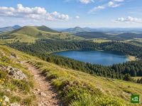
The GR30 loops the volcanic heart of the Auvergne, linking the crater lakes of the Massif Central: Pavin, Chambon, Guéry and Servières. Between them the route crosses the Puy de Sancy, high summer pastures, beech woods and the stone villages of the Artense plateau.
GR30 map
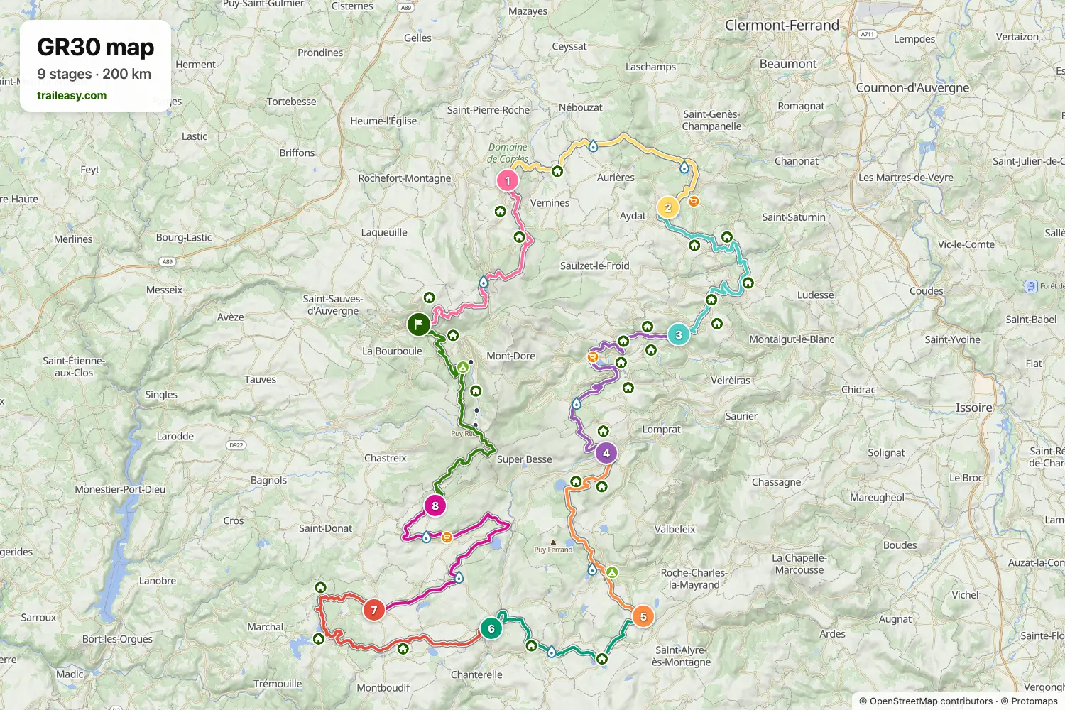
The interactive map shows the whole route, with accommodation, water and public transport along the way.
GR30 route planner
Build a day-by-day itinerary in the route planner, find accommodations along the route, and download the GPX file. Start from an example below or from scratch.
9-Day ItineraryShown below
The classic circuit of the Auvergne lakes, walked clockwise from La Bourboule. The first day climbs past Lac de Guéry and Lac de Servières to Orcival, the second crosses the southern Chaîne des Puys to Lac d'Aydat, then the route drops to the cheese village of Saint-Nectaire and climbs past Lac Chambon to Besse. From there it passes Lac Pavin and Lac de Montcineyre, crosses the open Cézallier by Compains, La Godivelle and Égliseneuve-d'Entraigues, and turns north through the Artense past Lac Chauvet to Picherande, before going over the Puy de Sancy to close the loop.
GR30 stages
9 days, 203 km and 6,088 m of ascent. These stages follow the 9-Day Itinerary. Open it in the route planner to split or merge days and choose where you sleep.
- Stage 121.8 km↑ 933 m · ↓ 979 m ·
8–9h with stopsLa Bourboule Orcival
Night at Auberge le Cantou - Stage 222.6 km↑ 578 m · ↓ 602 m ·
7–8h with stopsOrcival Aydat
Night at Le Marius Hotel - Stage 322.2 km↑ 630 m · ↓ 770 m ·
7–8h with stopsAydat Saint-Nectaire
Night at Logis Hôtel de la Paix - Stage 424.3 km↑ 898 m · ↓ 580 m ·
8–9h with stopsSaint-Nectaire Besse-et-Saint-Anastaise
Night at Hotel Restaurant Piscine Le Clos - Stage 519.3 km↑ 657 m · ↓ 461 m ·
6–7h with stopsBesse-et-Saint-Anastaise Compains
Night at Gîte Lapier - Stage 616.7 km↑ 321 m · ↓ 590 m ·
5–6h with stopsCompains Égliseneuve-d'Entraigues
Night at La Grange gîte d étape chambres d hôtes - Stage 723.6 km↑ 500 m · ↓ 437 m ·
7–8h with stopsÉgliseneuve-d'Entraigues Saint-Genès-Champespe
Night at Hotel du Midi - Stage 826.0 km↑ 544 m · ↓ 387 m ·
8–9h with stopsSaint-Genès-Champespe Picherande
Night at Auberge Du Taraffet - Stage 926.2 km↑ 1,027 m · ↓ 1,282 m ·
9–10h with stopsPicherande La Bourboule
Best time to go
- Best time1 Jun – 30 Sept
- Good time1 Oct – 15 Oct
- Possible, with care1 May – 31 May, 16 Oct – 31 Oct
The season is May to the middle of October, which is when the gîtes d'étape open and close. Snow lingers on the Sancy ridges into late May. June has the flowering at altitude and the longest daylight, July and August the settled weather and beds that need booking well ahead, September the quiet paths and the first autumn colour. Outside that the plateau is under snow, and the circuit is closed to walkers while the Sancy ski resorts are running.