
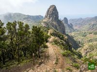
GR131 La Gomera
About GR131 La Gomera
A crossing of La Gomera from the harbour at San Sebastián to Vallehermoso in the north, through the laurel cloud forest of Garajonay. It climbs terraced ridges and deep barrancos into a moss hung relict forest that once covered much of the Mediterranean, often under drifting cloud.
GR131 La Gomera map
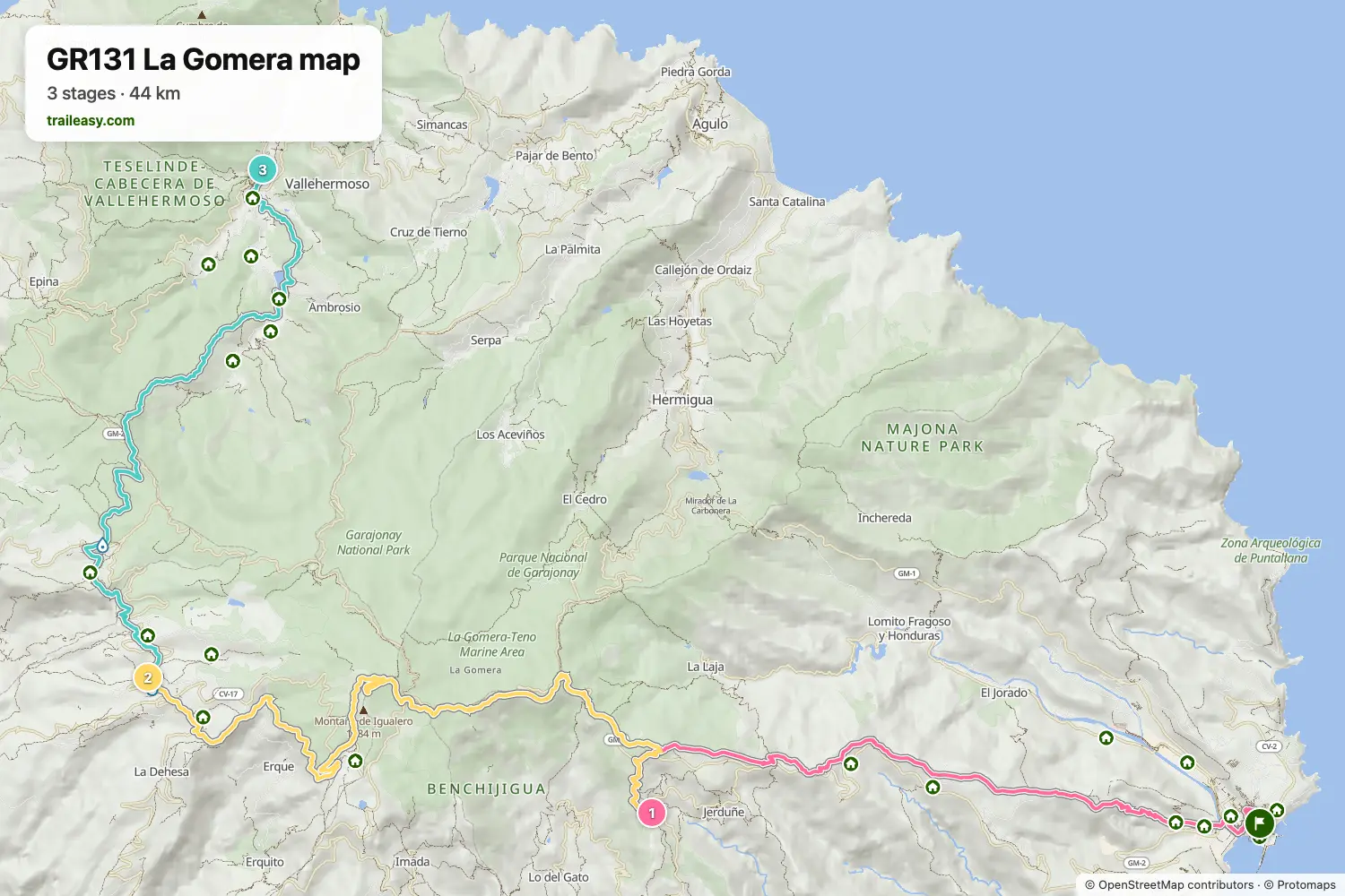
The interactive map shows the whole route, with accommodation, water and public transport along the way.
GR131 La Gomera route planner
Build a day-by-day itinerary in the route planner, find accommodations along the route, and download the GPX file. Start from an example below or from scratch.
3-Day ItineraryShown below
A three day crossing of La Gomera from the harbour at San Sebastián to Vallehermoso in the north. The route climbs terraced ridges above the Degollada de Peraza, spends a night high on the island at Vegaipala, then threads the moss hung laurel forest of Garajonay by way of Chipude before descending the northern barrancos to the coast.
GR131 La Gomera stages
3 days, 46 km and 2,751 m of ascent. These stages follow the 3-Day Itinerary. Open it in the route planner to split or merge days and choose where you sleep.
- Stage 114.5 km↑ 1,285 m · ↓ 453 m ·
6–7h with stopsTo Vegaipala
Night at Casa Rural La Palizada - Stage 217.3 km↑ 978 m · ↓ 846 m ·
6–7h with stopsThrough Garajonay Chipude
Night at Casa rural Adoracion - Adults Only - Stage 314.4 km↑ 488 m · ↓ 1,357 m ·
5–6h with stopsChipude Vallehermoso
Best time to go
- Best time1 Mar – 31 May, 1 Oct – 30 Nov
- Good time1 Jun – 30 Sept, 1 Dec – 29 Feb
October and November and then March to May are the best stretches, with clear high ground and comfortable temperatures. La Gomera has a milder year round climate than the eastern islands, so summer only really bites on the long descents and the laurel forest stays cool. From December to February the island is at its wettest and the forest paths under the laurisilva get slippery.
Frequently asked questions
How many days do you need for the GR131 La Gomera?
Three days is the standard split and four is comfortable, which makes this the one Canary crossing that fits into a long weekend. The route runs from the harbour at San Sebastián up through the Garajonay laurel forest and down to Vallehermoso on the north coast, and its shortness is deceptive because the climbing is concentrated. Three days means two substantial climbs on consecutive days with a long descent at the end. Four gives you time in the cloud forest, which is the reason most people come, rather than hurrying through it. Traileasy will lay the crossing out as three days or as four so you can see what each version asks of you, which matters more here than on the longer islands because one extra day changes the shape of the whole trip.
Is the GR131 La Gomera easy because it is short?
No, it is short and steep rather than short and easy. La Gomera is cut by deep ravines running from the central massif down to the sea, and the trail climbs and drops through them rather than contouring around, so the height gained per day is high for the ground covered. The surfaces are generally good, with a lot of old stone-laid track and forest path, but there is very little flat walking anywhere on the route. Expect a long sustained climb out of San Sebastián and a steep descent to Vallehermoso at the end. Anyone comfortable on steep ground will enjoy it, and anyone judging it purely by the distance will be surprised.
Can you combine the GR131 and GR132 into a circuit of La Gomera?
Yes, and it is one of the better ways to see the island. The GR132 is the coastal route that runs right around La Gomera, and because the GR131 crosses the middle from San Sebastián to Vallehermoso, the two together close into a loop with no repeated ground. Walking the crossing first and then following the coast back around, or the reverse, turns a three-day trip into something closer to a week and a half depending on how you split it. The coastal route is a different kind of walking: hotter, drier, more exposed, with its own steep barranco crossings and far less shade. Treat them as two plans joined at the ends rather than one continuous route, since the accommodation and water situations are not alike.
Where do you stay on the GR131 La Gomera?
San Sebastián at the start and Vallehermoso at the finish both have a reasonable choice, and the middle of the route relies on small villages around the Garajonay area such as Chipude, El Cercado and La Laguna Grande. There is not much of it, and this is the practical detail worth knowing: many guesthouses on this island are not listed on the usual booking sites at all, so you have to contact them directly, and several will only take a two-night minimum. That quietly pushes people towards a four-day itinerary whether they planned one or not. Book well ahead for January to March, when the island's walking season is busiest, and do not expect any mountain huts, because there are none on the route.
When is the best time to walk the GR131 in La Gomera?
Roughly October to May, though La Gomera has a milder year-round climate than the eastern islands. The distinctive factor here is cloud: the northeast trade winds pile moisture against the central massif, so the Garajonay laurel forest sits under a sea of low cloud for much of the year, and that is precisely what keeps it alive. Expect the crossing to be sunny at the coast and damp, cool and misty on top, sometimes on the same day, so carry a windproof layer even in warm months. Winter is the wettest period and the forest paths get slippery, while late spring gives clearer high ground without summer heat on the descents. If you want the forest at its most atmospheric rather than its clearest, the cloud is the point rather than a problem.
How do you get to La Gomera to walk the GR131?
By ferry from Tenerife, which is how almost everyone arrives. Boats run from Los Cristianos in southern Tenerife to San Sebastián de La Gomera several times a day and take about an hour, landing you directly at the start of the route. Los Cristianos is close to Tenerife South airport, so the connection from a morning flight is straightforward. La Gomera does have a small airport with flights from Tenerife North, but the schedule is thin and it sits at the wrong end of the island for the trail. Coming back from Vallehermoso at the finish means a bus or taxi across to San Sebastián for the return ferry, so check the timetable, since services are sparse on Sundays.
Can you camp on the GR131 in La Gomera?
Not freely, and less so than on the other islands. Most of the route passes through Garajonay National Park, where camping is prohibited and the rules are taken seriously, and it is not permitted elsewhere on the island either. The one established option near the route is the campsite at El Cedro on the northern side of the forest, which is privately run and needs booking ahead. Because the crossing is short and the villages sit at sensible intervals, La Gomera is the easiest of the six to walk without a tent, so the simplest approach is to book beds and leave the camping gear at home. If you do want a night out, arrange it at El Cedro rather than improvising inside the park.