
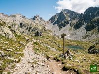
GR11
Also known as Senda Pirenaica
About GR11
A long-distance trail traversing the Spanish side of the Pyrenees from Cap de Higuer on the Atlantic coast to Cap de Creus on the Mediterranean. The route crosses Basque hills, the high glaciated peaks and lakes of Aragón and Catalonia, and the rugged coastal sierras of the Costa Brava, linking remote mountain villages, alpine refuges, and three national parks along the way.
GR11 map
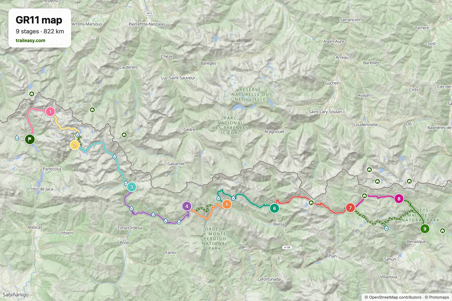
The interactive map shows the whole route, with accommodation, water and public transport along the way.
GR11 route planner
Build a day-by-day itinerary in the route planner, find accommodations along the route, and download the GPX file. Start from an example below or from scratch.
9-Day ItineraryShown below
The classic nine-day crossing of the Aragonese high Pyrenees, the most-walked stretch of the GR11, from the Tena valley village of Sallent de Gállego east to Benasque. The route climbs past the Respomuso reservoir to the Cuello de Tebarray and drops through the granite tarns of Bachimaña to the spa basin of Baños de Panticosa, then crosses into the Ara valley for Bujaruelo and the limestone amphitheatre of Ordesa y Monte Perdido National Park, with a night at the Góriz refuge below Monte Perdido. Beyond the Collado de Añisclo it descends to the Pineta valley and works east through Parzán and the Urdiceto pass into the Posets-Maladeta Natural Park, over the Puerto de Chistau to the Estós refuge and down the Ésera valley to Benasque. Nights are spent in mountain refuges and valley hotels, and both ends of the walk are served by bus.
GR11 stages
9 days, 144 km and 8,662 m of ascent. These stages follow the 9-Day Itinerary. Open it in the route planner to split or merge days and choose where you sleep.
- Stage 111.3 km↑ 949 m · ↓ 89 m ·
4–5h with stopsSallent de Gállego Respomuso
Night at Refugio Respomuso - Stage 212.5 km↑ 793 m · ↓ 1,297 m ·
5–6h with stopsRespomuso Baños de Panticosa
Night at Refugio de Montaña Casa de Piedra - Stage 320.8 km↑ 1,027 m · ↓ 1,327 m ·
8–9h with stopsBaños de Panticosa Bujaruelo
Night at Refuge Bujaruelo - Stage 424.9 km↑ 1,402 m · ↓ 550 m ·
9–10h with stopsBujaruelo Góriz
Night at Refugio de Góriz - Ordesa (2200 m) - Stage 513.2 km↑ 969 m · ↓ 1,917 m ·
6–7h with stopsGóriz Pineta
Night at Refugio de Pineta - Stage 619.5 km↑ 990 m · ↓ 1,108 m ·
7–8h with stopsPineta Parzán
Night at Hostal La Fuen - Stage 721.1 km↑ 1,536 m · ↓ 929 m ·
8–9h with stopsParzán Biadós
Night at Refuge Biadós - Stage 811.2 km↑ 936 m · ↓ 772 m ·
5–6h with stopsBiadós Estós
Night at Refugio De Estos - Stage 99.1 km↑ 60 m · ↓ 652 m ·
3–4h with stopsEstós Benasque
Best time to go
- Best time1 Jul – 15 Sept
- Good time16 Jun – 30 Jun
- Possible, with care16 Sept – 30 Sept
July to mid-September is the reliable stretch on the Spanish side of the range, with the refugios staffed throughout. The Aragonese slopes clear a little earlier than the French side, though the high cols still hold snow into early July. From the middle of September the refugios begin closing and resupply gets thinner between villages.
Frequently asked questions
How many days does the GR11 take, and can you walk it in sections?
Most people take 40 to 50 days to walk the whole GR11, which comes to six or seven weeks once you add a few rest days. Only very strong walkers get close to a month. Plenty never try it in one go. The route splits naturally into four sections of ten days to two weeks: the Basque and Navarrese hills to Candanchú, the high central Pyrenees to la Guingueta d'Àneu, Andorra and the Cerdanya to Puigcerdà, and the drier, lower hills down to the Mediterranean. The central one is by far the hardest. Candanchú, with Canfranc station just down the valley, and Puigcerdà, with trains to Barcelona, are the easiest places to stop one summer and pick up the next. Nine of the GR11's alternative lines are built into the Traileasy planner, Ezkaurre in Navarra and the Faja de las Olas in Ordesa among them, and switching one into a stage updates its distance and climb.
How hard is the GR11, and do you need an ice axe and crampons?
It is hard, mostly because it goes on for so long. Over the whole traverse you climb more than four times the height of Everest, and the central passes cross boulder fields and steep rocky ground where the path all but disappears. None of it is rock climbing. What wears people down is the length of the days, week after week. The red and white waymarks are generally good, if patchy in places, and fog in the Navarrese hills can make the first week awkward. Whether you need an ice axe depends on your start date. In early June, central passes such as Tebarray above Respomuso and Noucreus above Núria can still call for crampons and an axe, while in recent summers they have rarely needed them from July onward. If you carry only one, make it crampons, and ask the refugio guardians about snow on the next col before you cross it.
Does the GR11 go through France or Andorra?
It crosses Andorra, but its current official line no longer enters France. The old route dipped into France through the Sansanet forest before Candanchú. That stage has been dropped, and the GR11 now goes by the Lizara refuge instead, a day longer, so guidebooks that still describe a French detour are out of date. Andorra takes three or four days, with Encamp the place to restock. It sits outside the EU's roaming rules. Check your phone plan.
Which direction should you walk the GR11, and how do you get to the start and home again?
West to east, from the Atlantic to the Mediterranean, is the official direction and the one the stage guides follow. It puts the prevailing weather at your back and gives the central passes about two weeks to shed their snow before you reach them. The cost is heat at the end, on dry tracks through the Empordà hills. Getting to the start is easy. San Sebastián's airport is in Hondarribia itself, buses link the town with San Sebastián and Irun, and the lighthouse at Cabo de Higuer is a short walk out of town. Getting home takes more thought. Cap de Creus has no public transport, so most walkers take a taxi or walk on to Cadaqués for the Moventis Sarfa bus to Figueres and Barcelona, which runs less often outside summer.
Can you walk the GR11 without a tent, and do you need to book the refugios?
Yes. Nearly every stage ends at a staffed refugio, a hostel or a village hotel, and the staffed huts serve dinner and breakfast. A few nights need planning. The third day, out of Elizondo, ends at the Puerto de Urkiaga with nowhere to sleep, so you either drop down to Eugi or split the days differently. Baiau below the Andorran border and Talaixà in the Alta Garrotxa are free, unstaffed huts, and Talaixà sleeps only about eight, so carry a sleeping bag, a stove, food and a bivouac bag in case a hut is full. For most refugios a call a day or two ahead is enough. Góriz, below Monte Perdido, is the exception: it fills months ahead, and bookings for 2027 open online on 6 January. Plan the nights in the Traileasy planner and any stop at Góriz or an unstaffed hut stands out before you book anything.
Where can you resupply on the GR11, and what is the longest stretch without a shop?
The longest gap is in the high central section, from Parzán to Espot, where the route passes no village shop for about a week. Stock up in Parzán, on the road to the Bielsa tunnel. You still eat well. Staffed refugios such as Biadós, Restanca and Colomers serve dinner and breakfast and sell picnic lunches, so the load is mostly snacks and a spare day's food, and a detour down the valley to Benasque reaches proper supermarkets. Elsewhere two or three days of food is plenty, with shops at Elizondo, Ochagavía and Isaba in Navarra, Encamp in Andorra, and Puigcerdà, Molló and Llançà in the east. Carry more water in the lower eastern hills, where some streams dry up by August.
Can you wild camp on the GR11?
Only in some places, and the rules change as you cross from one region or park into the next. Aragón bans wild camping but, outside protected areas, allows high-mountain camping for up to three nights, at least two hours' walk from any road and above a set altitude, as long as you notify the comarca and the 112 SOS Aragón service. Protected areas set their own rules, and the national parks are stricter. In the Ordesa sector of Ordesa y Monte Perdido, camping has been banned since 2022 except at the Góriz camping area, which takes 50 people a night and must be booked. Elsewhere in that park a small tent is allowed only above set altitudes, from an hour before sunset to an hour after sunrise. Aigüestortes allows no night out at all away from the refuges. Since 2026 the Ibones de Anayet, between Candanchú and Sallent de Gállego, have been closed to camping each summer from 21 June to 21 September. Navarra requires the local council's permission. In 2018 the Alt Pirineu park allowed a single night high above the Vall Ferrera, from 8pm to 8am; ask the park office whether that still holds. Several of these rules are new. Check them again before each season.