
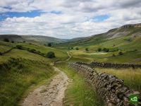
Dales High Way
About Dales High Way
The Dales High Way takes the high line across the Yorkshire Dales, from the Victorian mill village of Saltaire to Appleby-in-Westmorland in the Eden Valley. It climbs the heather moorland of Rombalds Moor, passes the limestone amphitheatre of Malham Cove, summits Ingleborough and finishes with a long ridge walk over the Howgill Fells.
Dales High Way map
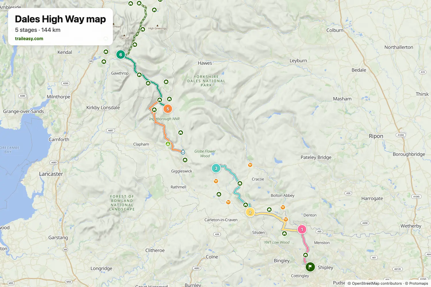
The interactive map shows the whole route, with accommodation, water and public transport along the way.
Dales High Way route planner
Build a day-by-day itinerary in the route planner, find accommodations along the route, and download the GPX file. Start from an example below or from scratch.
8-Day ItineraryShown below
The high-level line through the Yorkshire Dales, from the Victorian mill village of Saltaire to Appleby-in-Westmorland in the Eden Valley. It crosses the heather of Rombalds Moor to Ilkley, runs by castle town Skipton to the great limestone cove at Malham, climbs Ingleborough from Settle before dropping to the Ribblehead viaduct, then follows lovely Dentdale to Sedbergh and takes the long whaleback ridge of the Howgill Fells and the limestone pavements of Great Asby Scar to finish. Village inns and farmhouse stays the whole way.
Dales High Way stages
8 days, 156 km and 4,507 m of ascent. These stages follow the 8-Day Itinerary. Open it in the route planner to split or merge days and choose where you sleep.
- Stage 113.0 km↑ 339 m · ↓ 308 m ·
4–5h with stopsTo Ilkley
Night at The Craiglands Hotel, Sure Hotel Collection by Best Western - Stage 218.9 km↑ 524 m · ↓ 546 m ·
6–7h with stopsIlkley Skipton
Night at The Woolly Sheep Inn - Stage 321.2 km↑ 740 m · ↓ 653 m ·
7–8h with stopsSkipton Malham
Night at The Lister Arms - Stage 416.4 km↑ 477 m · ↓ 465 m ·
5–6h with stopsMalham Stainforth
Night at Knight Stainforth Hall Camping & Caravan Park - Stage 526.1 km↑ 869 m · ↓ 785 m ·
9–10h with stopsStainforth Ribblehead
Night at Ashes Farm Bed & Breakfast, Holiday Cottage and lodges, Near Settle North Yorkshire - Stage 622.4 km↑ 502 m · ↓ 660 m ·
7–8h with stopsRibblehead Sedbergh
Night at The Black Bull Inn - Stage 718.0 km↑ 796 m · ↓ 674 m ·
6–7h with stopsSedbergh Orton
Night at Ashley Bank Holiday Cottages - Stage 819.9 km↑ 260 m · ↓ 385 m ·
6–7h with stopsOrton Appleby-in-Westmorland
Best time to go
- Best time1 May – 30 Jun, 1 Sept – 30 Sept
- Good time1 Apr – 30 Apr, 1 Jul – 31 Aug, 1 Oct – 31 Oct
- Possible, with care1 Nov – 31 Mar
May, June and September are the best months, with daylight enough for the big days over Ingleborough and the Howgills and the moorland ground dried out. July and August fill the beds in Sedbergh and Dent and bring the crowds to Malham Cove. From November to March Ingleborough and the Howgill ridge sit in cloud for days at a time and hold snow well into spring.
Frequently asked questions
When is the best time to walk the Dales High Way?
May, June and September. What makes this route different from the low level Dales Way is that it spends its days on the tops, so the ground underfoot follows the last fortnight of weather rather than the month on the calendar. Peat moor that is firm in a dry June is heavy going in a wet one. The heather on Rombalds Moor and the high ground colours through late August if you want to time it for that. Come between November and March and treat it as a mountain walk rather than a long-distance path, since Ingleborough and the Howgill ridge can sit in cloud for days and hold snow long after the valleys have cleared.
How many days do you need for the Dales High Way?
Most walkers take about eight days, though the route stretches or compresses a fair way either side of that. The official route guide divides the walk into six natural sections, and operators who run it as a supported holiday usually schedule somewhere between a week and ten days. Eight days keeps the daily effort comfortable on a route that is genuinely hilly, with the climb over Ingleborough and the ridge across the Howgills each getting a day to itself. Strong walkers combine two of the shorter sections and finish in six or seven, while anyone wanting time for Malham Cove, Dent and the Settle-Carlisle stations spreads it to nine or ten. Because this is a high route rather than a valley one, plan by ascent and exposure rather than by distance, since the tops slow you down far more than the map suggests. Traileasy carries the Howgills low level alternative alongside the main line, so a plan built around the ridge day can be swapped for the valley version to see whether Sedbergh or Ravenstonedale ends up as the overnight.
How hard is the Dales High Way?
It is a demanding walk, and noticeably harder than its length alone suggests. The route is called a high way for a reason, since it takes the tops rather than the valleys, and the cumulative ascent puts it closer to a mountain route than to a typical long distance path. Ingleborough and the ridge over the Howgill Fells are the two big days, and much of the ground between them is rough moorland, tussock and peat rather than a made path. Nothing on the route is technical and there is no scrambling, so the difficulty is about stamina, rough ground and navigation rather than nerve. Hill fitness and confidence with a map and compass in poor visibility count for more here than on a waymarked valley trail, and anyone unsure of those should look at the low level alternatives the guidebook gives for the highest sections.
What is the difference between the Dales Way and the Dales High Way?
They are two separate trails that happen to share the Yorkshire Dales and a confusingly similar name. The Dales Way is the older and gentler of the two, running from Ilkley to Bowness-on-Windermere largely along river valleys, and it is popular as a first long distance walk because the going is easy and the navigation straightforward. The Dales High Way runs from Saltaire to Appleby-in-Westmorland and deliberately takes the high ground instead, crossing Rombalds Moor, the limestone country above Malham, Ingleborough and the Howgill ridge. The two come close only around Dentdale, so walking one tells you very little about the other. If you want valley scenery, riverside walking and pubs at regular intervals, take the Dales Way; if you want summits, long views and a real hill day most days, take the Dales High Way.
How do you get to the start, and how do you get back from Appleby?
Both ends sit on the railway, which is one of the route's real conveniences. The walk starts at Victoria Square in Saltaire, a few minutes from Saltaire station on the line out of Leeds and Bradford, and finishes by the Moot Hall on Boroughgate in Appleby-in-Westmorland, which has its own station on the Settle-Carlisle line. Most walkers ride the Settle-Carlisle back south at the end, and since the route shadows that line for much of its length the journey retraces the walk in reverse past Ribblehead and Dent. That same railway is what makes the trail easy to break into separate trips, because Settle, Ribblehead, Dent, Garsdale, Kirkby Stephen and Appleby all have stations within reach of the route. Check for engineering works before you rely on it, since weekend closures on the Settle-Carlisle are common and worth confirming close to your dates.
Can you wild camp on the Dales High Way?
Not as of right. England has no general legal right to wild camp, so unlike most of Scotland, pitching a tent along the Dales High Way needs the landowner's permission. In practice, discreet camping high on the fells is often tolerated if you arrive late, leave at first light, pitch out of sight of houses and roads, take everything away and light no fire, but that is tolerance rather than permission and a farmer can still move you on. The Yorkshire Dales National Park authority grants no blanket permission, and the lower ground along the route is nearly all enclosed farmland where camping is clearly not on. Most people walking it with a tent use the campsites and camping barns in the villages instead, which also solves water and resupply, and those are worth booking ahead in high summer.