
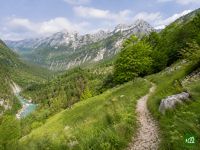
Alpe Adria Trail
About Alpe Adria Trail
A long walk from the Alps to the Adriatic, from the foot of the Grossglockner to the coast near Trieste. It links the glaciers and lakes of Carinthia with the forests of Slovenia and the vineyards and karst of the Italian coast, crossing three countries and their cultures and cuisines.
Alpe Adria Trail map
The interactive map shows the whole route, with accommodation, water and public transport along the way.
Alpe Adria Trail route planner
Build a day-by-day itinerary in the route planner, find accommodations along the route, and download the GPX file.
Open the Alpe Adria Trail route plannerBest time to go
- Best time16 Jun – 30 Sept
- Good time1 Jun – 15 Jun, 1 Oct – 15 Oct
- Possible, with care16 Apr – 31 May, 16 Oct – 31 Oct
The whole trail is in season from the middle of June to the end of September, since snow lies on the high Carinthian stages into June. From June to August the nine low stages from Cividale to the sea are hot and suit spring or autumn better. From the middle of April to the end of May, and once Carinthia's walking season ends in early October, walk a section south of the Karawanks, where snow can linger on the Vršič and Solarji passes in spring.
Frequently asked questions
When is the best time to walk the Alpe-Adria-Trail?
For the whole trail, from the middle of June to the end of September, but no single month suits every stage, because the route drops from a glacier to the sea. Stage 1 starts in high alpine terrain below the Grossglockner, where the operator warns of short snowfields. The last nine stages cross low wine hills and the Karst to the Adriatic. Start in mid-June and you reach them in high summer, when they are hot. Wikivoyage suggests setting off in the last week of August instead: the mountain huts are still open, and four to five weeks later the Italian lowlands have begun to cool. The other way is two trips. The trail's booking centre in Bovec recommends the Austrian and alpine Slovenian stages for June to August, and Cividale to Muggia walks better in spring or autumn.
How long is the Alpe-Adria-Trail, and how many days does it take?
The through-route has 37 stages, from the Kaiser-Franz-Josefs-Höhe below the Grossglockner to Muggia on the Adriatic. With rest days and a few days lost to weather, six weeks is a realistic plan. The 43 stages in the official count add a circular route of six stages between the Faaker See and Kranjska Gora, through the corner where Austria, Italy and Slovenia meet, which you walk in place of stage 22. The length in the operator's and the Carinthia tourist board's headline is a round figure that matches neither count: the 37 stages add up to a little less, and all 43 to rather more. The operator's walking times come to about 240 hours, an average of about six and a half hours a day, and the longest stages take around eight. In the Traileasy planner the circular route is a variant, so you can add it and see how much distance and climbing it puts on top of stage 22.
What are the most beautiful stages of the Alpe-Adria-Trail for a week, and how hard are they?
On the operator's own ratings, seven of the eight stages with the top landscape score fall into three sections, and each fits a week. Kranjska Gora to Cividale is six stages over the Vršič Pass, down the Soča valley past Trenta, Bovec and Tolmin, and over the border into Italy. The trail's booking centre in Bovec recommends these alpine Slovenian stages for summer. The first six stages run from the Pasterze glacier below the Grossglockner to Mallnitz in the Hohe Tauern National Park, which has a railway station. Seeboden to Bad Kleinkirchheim is five stages above Lake Millstatt and over the ridges of the Nockberge biosphere park. As for difficulty, the operator rates the trail easy to moderate, with no roped or exposed passages, but you need sure feet on rocky ground and the fitness for days of up to eight hours. Eight of the nine stages it rates hardest are in these sections: the Vršič crossing and the stages either side of Tolmin, stages 5 and 6 into Mallnitz, and three of the five Nockberge days. The gentlest stretch is the last nine stages from Cividale, through the Brda and Collio wine hills and the Karst to the sea.
How do you get to the start of the Alpe-Adria-Trail at the Kaiser-Franz-Josefs-Höhe?
By bus from Heiligenblut, the village where the first stage ends. Several public buses a day run to Heiligenblut from Spittal an der Drau and Lienz, both on the railway, and in the summer months a shuttle bus goes on up to the Kaiser-Franz-Josefs-Höhe three times a day. Postbus publishes the timetable. Outside those times the operator points to a taxi from Heiligenblut. The road up is the toll Grossglockner High Alpine Road, open from early May to early November. Because stage 1 ends back in Heiligenblut, you can sleep there, ride up in the morning and walk down to the same bed. More than 95 percent of walkers go from the glacier to the sea, according to the operator. At the far end, boats run several times a day from Muggia to Trieste, which has a railway station.
How far ahead should you book accommodation on the Alpe-Adria-Trail?
For July and August, as early as you can, since the operator warns that some stops run short of beds in high season. Book first the nights where a stage ends at huts or mountain inns instead of a village: the Millstätter Alpe, the Langalmtal, the Falkerthaus or Lärchenhütte, and the Gerlitzen Alpe. Wikivoyage adds that some Carinthian guesthouses prefer weekly lets in midsummer, which makes single nights harder to find. You can book each night yourself from the accommodation list on the official site, or hand the whole tour to the Alpe-Adria-Trail Booking Center. It lets you start on any day and any stage. Its luggage transport and shuttles are only sold together with accommodation booked through it.
Can you cycle the Alpe-Adria-Trail, or is that the Alpe-Adria-Radweg?
No. The Alpe-Adria-Trail is a walking route, and the operator says most of it runs on footpaths where mountain biking is forbidden by law. The shared name causes the mix-up. The Alpe-Adria-Radweg is a separate cycle route from Salzburg to Grado, eight stages and about a week by bike, on a different line from the walking trail, which ends at Muggia.
Are any stages of the Alpe-Adria-Trail closed or diverted?
Two diversions are standing rules, and the operator posts everything else on its Stage News page. On stage 10 the Drachenschlucht suspension bridge is open from early June to mid-September, daily from 9:30 to 16:30, and shut in rain. At other times you leave the trail at Altersberg and follow the country road through Oberallach and Trebesing to Gmünd, with a lot of asphalt. On stage 7 the Groppenstein and Rabisch gorges are open in daylight only and close in bad weather or outside their opening hours, with detours in place. Anything else, from forestry work to storm damage, goes on Stage News, which also lists each stage as accessible or not. Check it, and the notice on each stage's own page, shortly before you set off, since both change through the season. In the Traileasy planner the Oberallach route is a variant of stage 10, so you can plan that day for a shut bridge too.