
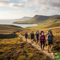
Coast to Coast Walk
À propos de Coast to Coast Walk
La traversée du nord de l'Angleterre conçue par Alfred Wainwright, de St Bees, sur la mer d'Irlande, à Robin Hood's Bay, sur la mer du Nord. Elle passe par trois parcs nationaux, des montagnes du Lake District aux landes de bruyère des North York Moors, en franchissant les Pennines à Nine Standards Rigg puis en traversant Swaledale, dans les Yorkshire Dales. La tradition veut qu'on trempe ses chaussures de marche dans la mer au départ et à l'arrivée.
Coast to Coast Walk : la carte
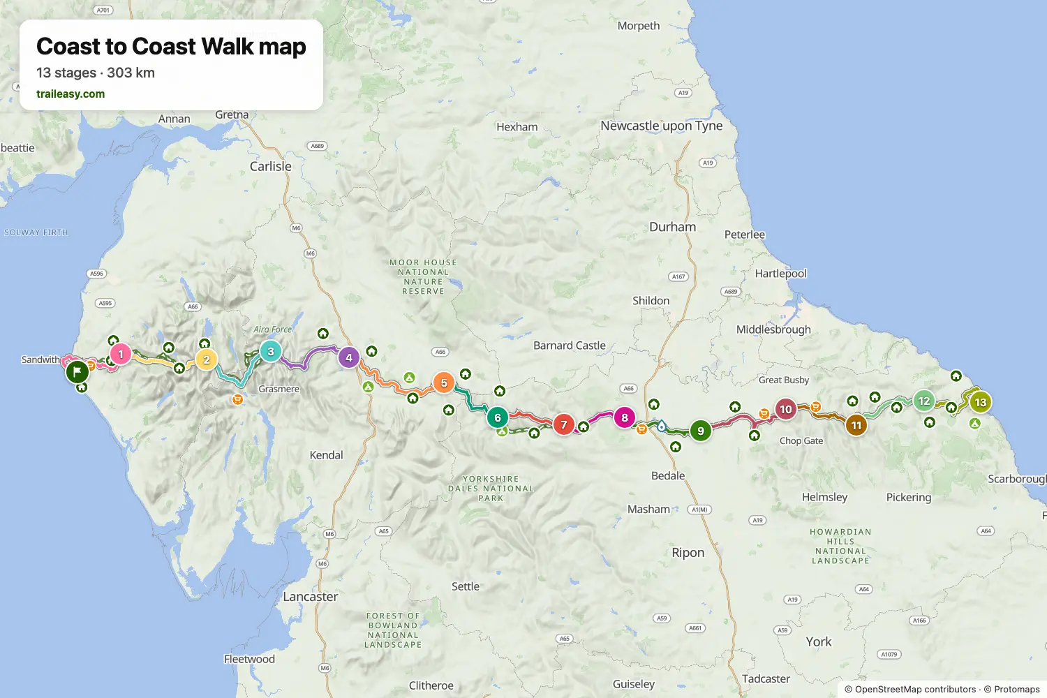
La carte interactive montre tout le parcours, avec les hébergements, les points d'eau et les transports en commun le long du chemin.
Planificateur d'itinéraire Coast to Coast Walk
Créez un itinéraire jour par jour dans le planificateur, trouvez des hébergements le long du parcours et téléchargez le fichier GPX. Partez d'un exemple ci-dessous ou de zéro.
13 Days - Coast to Coast WalkAffiché ci-dessous
A classic crossing of northern England from the Irish Sea at St Bees to the North Sea at Robin Hood's Bay, covering 297km in 13 stages. The route traverses three national parks — the Lake District, the Yorkshire Dales, and the North York Moors — taking in dramatic mountain passes including Greenup Edge and Grisedale Tarn, the wild moorland of Kidsty Pike, and the iconic Lion Inn on Blakey Ridge. This split balances mountain days in the Lakes with rolling Dales stages and a memorable final stretch across the North York Moors to the sea.
16-Day Itinerary
The Coast to Coast Walk from St Bees to Robin Hood's Bay in sixteen days, a gentler split that cuts three long stages of the shorter plans in two. In the Lake District it breaks the crossing from Borrowdale to Patterdale with a night in Grasmere, which leaves a short day over Grisedale Hause and time for the fells above it. A night in Orton does the same between Shap and Kirkby Stephen. The Dales stages run as usual through Keld, Reeth and Richmond, and the Vale of Mowbray is crossed in two days to Ingleby Cross. On the North York Moors the walk stops at Beak Hills Farm, short of the Wainstones, and at the Lion Inn on Blakey Ridge before the last two stages to Grosmont and the sea.
Coast to Coast Walk : les étapes
13 jours, 299 km et 7 986 m de dénivelé positif. Ces étapes suivent l'itinéraire « 13 Days - Coast to Coast Walk ». Ouvrez-le dans le planificateur pour couper ou fusionner des journées et choisir où dormir.
- Étape 125,8 km↑ 806 m · ↓ 713 m ·
8–9h avec pausesVers Ennerdale
Nuit à Fox and Hounds Inn - Étape 223,7 km↑ 606 m · ↓ 614 m ·
8–9h avec pausesEnnerdale Borrowdale
Nuit à YHA Borrowdale - Étape 324,6 km↑ 1 153 m · ↓ 1 099 m ·
9–10h avec pausesBorrowdale Patterdale
Nuit à Patterdale Hotel - Étape 425,8 km↑ 999 m · ↓ 898 m ·
9–10h avec pausesPatterdale Shap
Nuit à The Greyhound Hotel, Bar & Restaurant - Étape 531,1 km↑ 656 m · ↓ 735 m ·
10–11h avec pausesShap Kirkby Stephen
Nuit à Black Bull - Étape 618,4 km↑ 606 m · ↓ 445 m ·
6–7h avec pausesKirkby Stephen Keld
Nuit à Keld Lodge - Étape 717,9 km↑ 576 m · ↓ 707 m ·
6–7h avec pausesKeld Reeth
Nuit à The Buck - Étape 816,7 km↑ 347 m · ↓ 419 m ·
5–6h avec pausesReeth Richmond
Nuit à The Kings Head Hotel - Étape 922,5 km↑ 145 m · ↓ 242 m ·
6–7h avec pausesRichmond Danby Wiske
Nuit à Rectory House Bed and breakfast - Étape 1027,8 km↑ 666 m · ↓ 411 m ·
9–10h avec pausesDanby Wiske Lordstones
Nuit à Lord Stones Country Park - Étape 1119,6 km↑ 598 m · ↓ 496 m ·
6–7h avec pausesLordstones Blakey Ridge
Nuit à The Lion Inn, Blakey Ridge - Étape 1221,5 km↑ 228 m · ↓ 580 m ·
6–7h avec pausesBlakey Ridge Grosmont
Nuit à Grosmont House Bed & Breakfast Whitby - Étape 1323,8 km↑ 600 m · ↓ 591 m ·
8–9h avec pausesGrosmont Robin Hood's Bay
Quand partir
- Meilleure période1 avr. – 30 juin, 1 sept. – 30 sept.
- Bonne période1 mars – 31 mars, 1 juil. – 31 août, 1 oct. – 31 oct.
- Possible, avec prudence1 nov. – 29 févr.
D'avril à juin et en septembre, ce sont les meilleurs mois, avec les cols du Lake District dégagés et assez de jour pour les longues étapes. La traversée de Nine Standards Rigg comporte trois itinéraires saisonniers destinés à protéger la tourbe, vérifiez donc lequel s'applique à vos dates. Juillet et août sont chauds et fréquentés, et de novembre à février les sommets du Lake District sont une course en montagne avec peu de jour.