
John Muir Way
Over John Muir Way
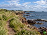
De John Muir Way doorkruist Schotland van kust tot kust, van Helensburgh aan de Firth of Clyde naar Dunbar aan de Noordzee, de geboorteplaats van natuurbeschermer John Muir. De route gaat over de heide boven Loch Lomond, volgt de oude kanalen langs de Muur van Antoninus naar het Falkirk Wheel, komt langs de Forthbruggen, gaat dwars door Edinburgh en eindigt langs de stranden en kliffen van East Lothian.
John Muir Way kaart
De interactieve kaart toont de hele route, met overnachtingen, waterpunten en openbaar vervoer onderweg.
Routeplanner John Muir Way
Stel in de routeplanner een planning per dag samen, vind overnachtingen langs de route en download het GPX-bestand. Begin met een voorbeeld hieronder of vanaf nul.
10-Day ItineraryHieronder getoond
The John Muir Way walked coast to coast in ten days on its ten official sections, from the start plinth on Helensburgh's waterfront to John Muir's Birthplace in Dunbar, with a few overnights shifted a little along the trail so that no day is far harder than the rest. The first day climbs over Gouk Hill for the first views of Loch Lomond, drops to Balloch and carries on through Balloch Castle Country Park to stop just beyond the town. That takes some of the weight off the second day, the crossing of the Kilpatrick Hills to Strathblane, which is the highest and most remote ground of the whole route and still the longest day. From there the walking eases onto the Strathkelvin Railway Path and the Forth and Clyde Canal, over the Roman fort on Bar Hill to Auchinstarry Marina, then along the Antonine Wall over Croy Hill and past Rough Castle to the Falkirk Wheel. Beyond Falkirk the Way passes Callendar House, follows the Union Canal and the River Avon to Linlithgow Bridge and climbs Fishers' Brae above Linlithgow, so the next morning starts in Kinneil Estate and Bo'ness before the Forth shore leads past Blackness Castle and Hopetoun to the three bridges at South Queensferry. Edinburgh comes by Cramond, Corstorphine Hill, the Water of Leith and the Union Canal. The last three days run out along the East Lothian coast through Musselburgh to Port Seton, by Aberlady, Gullane and Dirleton to North Berwick, then inland by East Linton and the River Tyne and back to the sea at John Muir Country Park for the finish.
John Muir Way etappes
10 dagen, 216 km en 2.360 m stijging. Deze etappes volgen de planning 10-Day Itinerary. Open die in de routeplanner om dagen te splitsen of samen te voegen en te kiezen waar je slaapt.
- Etappe 118,4 km↑ 454 m · ↓ 386 m ·
6-7 u met pauzesNaar Balloch
Overnachting in Westertonhill Holiday Lodges - Etappe 226,2 km↑ 490 m · ↓ 486 m ·
8-9 u met pauzesBalloch Strathblane
Overnachting in Kirkhouse Inn - Etappe 321,6 km↑ 163 m · ↓ 191 m ·
6-7 u met pauzesStrathblane Auchinstarry
Overnachting in The Boathouse Hotel Bar & Restaurant - Etappe 419,2 km↑ 258 m · ↓ 203 m ·
5-6 u met pauzesAuchinstarry Falkirk
Overnachting in Spoke'n'Boot Camping Pods - Etappe 518,9 km↑ 212 m · ↓ 218 m ·
5-6 u met pauzesFalkirk Linlithgow
Overnachting in Wester Muirhouse - Etappe 620,8 km↑ 109 m · ↓ 202 m ·
6-7 u met pauzesLinlithgow South Queensferry
Overnachting in Orocco Pier Hotel - Etappe 724,1 km↑ 305 m · ↓ 238 m ·
7-8 u met pauzesSouth Queensferry Edinburgh
Overnachting in Castle Park Guest House - Etappe 820,7 km↑ 75 m · ↓ 141 m ·
6-7 u met pauzesEdinburgh Port Seton
Overnachting in Anchorage B&B - Etappe 921,4 km↑ 85 m · ↓ 84 m ·
6-7 u met pauzesPort Seton North Berwick
Overnachting in Marine & Lawn North Berwick - Etappe 1025,1 km↑ 209 m · ↓ 200 m ·
7-8 u met pauzesNorth Berwick Dunbar
Beste reistijd
- Beste tijd1 apr – 30 jun, 1 sep – 30 sep
- Goede tijd1 mrt – 31 mrt, 1 jul – 31 aug, 1 okt – 31 okt
- Mogelijk, met voorzichtigheid1 nov – 29 feb
Het hele jaar te lopen: de route blijft overal laag en is zelden ver van een stad of een station. April, mei en juni zijn de droogste en zonnigste maanden, en in september is het rustiger als de zomervakantie voorbij is. Juli en augustus zijn natter, vooral aan de westkant, en voor Edinburgh in augustus, de maand van de festivals, kun je het best vroeg boeken. Van november tot en met februari is het maar zo'n zeven uur licht, te kort voor de lange tocht over de Kilpatrick Hills, en winterstormen teisteren de kust van East Lothian.