
Southern Upland Way
Informazioni su Southern Upland Way
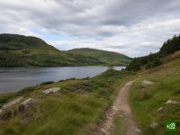
Il Southern Upland Way attraversa la Scozia da costa a costa, dal Mare d'Irlanda a Portpatrick fino al Mare del Nord a Cockburnspath. Percorre i boschi e i loch del Galloway, le brulle Lowther Hills, la valle del Tweed e le brughiere dei Lammermuir, con una parte centrale davvero isolata.
Southern Upland Way: la mappa
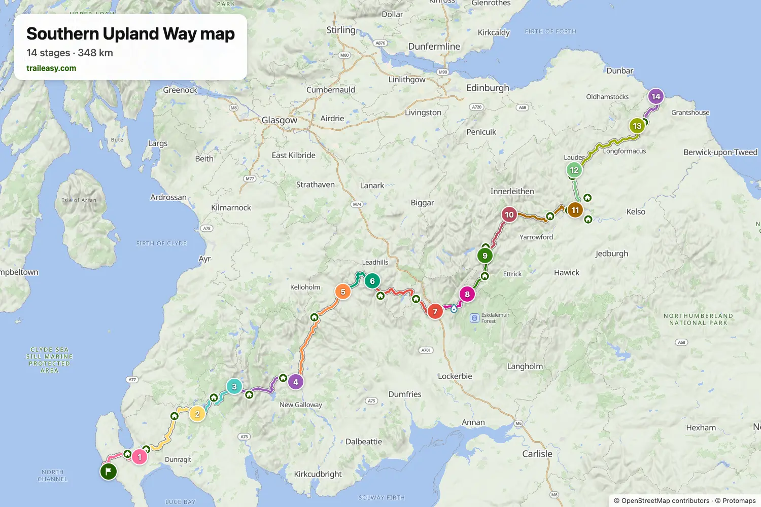
La mappa interattiva mostra tutto il percorso, con alloggi, punti acqua e trasporti pubblici lungo il cammino.
Pianificatore di percorso: Southern Upland Way
Crea un itinerario giorno per giorno nel pianificatore, trova alloggi lungo il percorso e scarica il file GPX. Parti da un esempio qui sotto o da zero.
14-Day ItineraryMostrato sotto
Britain's first official coast-to-coast route, walked west to east from the harbour at Portpatrick on the Rhins of Galloway to the North Sea at Cockburnspath. It crosses the Galloway forests and Loch Trool, then the empty hill country above St John's Town of Dalry — the loneliest part of the walk, and the reason one day here runs long. Beyond Sanquhar it climbs to Wanlockhead, Scotland's highest village, drops to Beattock and threads the Ettrick and Tweed valleys past St Mary's Loch, Traquair and Melrose before the Lammermuirs and the cliffs of the Berwickshire coast. Days alternate between big remote crossings and short valley stages, which is the rhythm the route itself sets.
Southern Upland Way: le tappe
14 giorni, 360 km e 8398 m di dislivello positivo. Queste tappe seguono l'itinerario «14-Day Itinerary». Aprilo nel pianificatore per dividere o unire le giornate e scegliere dove dormire.
- Tappa 121,8 km↑ 358 m · ↓ 375 m ·
6-7h con sosteVerso Castle Kennedy
Notte a Greenloch House - Tappa 236,6 km↑ 567 m · ↓ 476 m ·
11-12h con sosteCastle Kennedy Bargrennan
Notte a Waterside Newton Stewart - Tappa 325,6 km↑ 373 m · ↓ 372 m ·
8-9h con sosteBargrennan Glentrool
Notte a The Buchan - Tappa 428,6 km↑ 506 m · ↓ 548 m ·
9-10h con sosteGlentrool St John's Town of Dalry
Notte a The Clachan Inn - Tappa 542,2 km↑ 1129 m · ↓ 1055 m ·
14-15h con sosteSt John's Town of Dalry Sanquhar
Notte a The Nithsdale Hotel - Tappa 618,9 km↑ 709 m · ↓ 420 m ·
6-7h con sosteSanquhar Wanlockhead
Notte a Belton House Holiday Home - Tappa 732,5 km↑ 1042 m · ↓ 1367 m ·
11-12h con sosteWanlockhead Beattock
Notte a Telford Manor House and Mews Cottages - Tappa 816,1 km↑ 602 m · ↓ 328 m ·
5-6h con sosteBeattock Over Phawhope
Notte a Over Phawhope Bothy - Tappa 917,9 km↑ 319 m · ↓ 451 m ·
5-6h con sosteOver Phawhope St Mary's Loch
Notte a Tibbie Shiels Inn - Tappa 1017,5 km↑ 406 m · ↓ 466 m ·
5-6h con sosteSt Mary's Loch Traquair
Notte a The Grain Store - Tappa 1129,4 km↑ 865 m · ↓ 952 m ·
10-11h con sosteTraquair Melrose
Notte a Waverley Castle Hotel - Tappa 1217,5 km↑ 365 m · ↓ 285 m ·
5-6h con sosteMelrose Lauder
Notte a The Black Bull Hotel - Tappa 1334,8 km↑ 807 m · ↓ 826 m ·
11-12h con sosteLauder Longformacus
Notte a Green Hope - Tappa 1420,4 km↑ 350 m · ↓ 505 m ·
6-7h con sosteLongformacus Cockburnspath
Quando andare
- Periodo migliore1 mag – 30 giu, 1 set – 30 set
- Buon periodo1 apr – 30 apr, 1 lug – 31 ago, 1 ott – 31 ott
- Possibile, con attenzione1 feb – 31 mar, 1 nov – 30 nov
Maggio, giugno e settembre sono i mesi migliori, con il terreno al massimo dell'asciutto e luce a sufficienza per le tappe lunghe e isolate. A luglio e agosto arrivano moscerini e zecche sulla brughiera. Da febbraio a marzo e di nuovo a novembre la neve tiene sui valichi d'altura e la luce finisce presto. A dicembre e gennaio la tappa da Dalry a Sanquhar non ha alcun posto dove dormire e non sta più tra l'alba e il tramonto.