
Pembrokeshire Coast Path
Informazioni su Pembrokeshire Coast Path
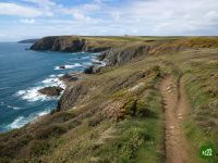
Il Pembrokeshire Coast Path segue la selvaggia costa a strapiombo del Galles sud-occidentale, da Amroth a sud fino a St Dogmaels a nord. Costeggia baie sabbiose, promontori rocciosi e colonie di uccelli marini, toccando la minuscola città cattedrale di St Davids.
Pembrokeshire Coast Path: la mappa
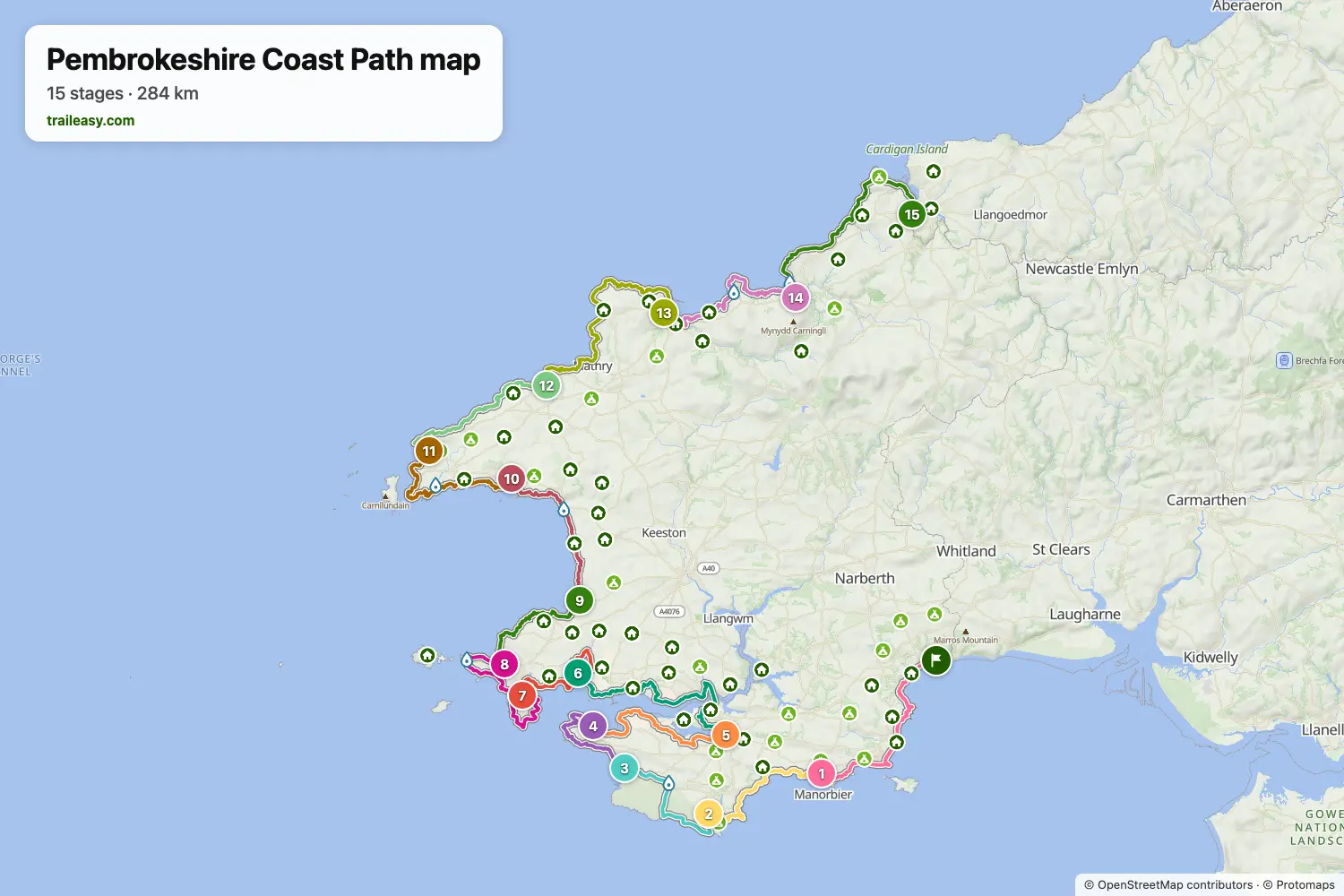
La mappa interattiva mostra tutto il percorso, con alloggi, punti acqua e trasporti pubblici lungo il cammino.
Pianificatore di percorso: Pembrokeshire Coast Path
Crea un itinerario giorno per giorno nel pianificatore, trova alloggi lungo il percorso e scarica il file GPX. Parti da un esempio qui sotto o da zero.
15-Day ItineraryMostrato sotto
The classic end-to-end walk of the Pembrokeshire Coast Path, south to north from Amroth to St Dogmaels, following the National Trail's own division of the route into day sections. The opening days round the limestone cliffs and hidden bays of south Pembrokeshire past Manorbier, Barafundle and St Govan's chapel, then cross the Castlemartin range by Freshwater West to Angle and follow the Milford Haven waterway inland to Pembroke before returning to open coast at Sandy Haven and Dale. From the Marloes peninsula the route works north through Broad Haven and Solva to the tiny cathedral city of St Davids and the rock-strewn headlands beyond, then along a remote, seabird-loud clifftop by Trefin, Pwll Deri and Strumble Head to Fishguard, finishing over the moorland shoulder of Carningli and the high cliffs of Cemaes Head to the northern trailhead above the Teifi estuary.
Pembrokeshire Coast Path: le tappe
15 giorni, 303 km e 8835 m di dislivello positivo. Queste tappe seguono l'itinerario «15-Day Itinerary». Aprilo nel pianificatore per dividere o unire le giornate e scegliere dove dormire.
- Tappa 122,7 km↑ 696 m · ↓ 674 m ·
7-8h con sosteAmroth Manorbier
Notte a Castle Mead Hotel - Tappa 218,1 km↑ 584 m · ↓ 579 m ·
6-7h con sosteManorbier Bosherston
Notte a St. Govan's Inn - Tappa 314,8 km↑ 104 m · ↓ 102 m ·
4-5h con sosteBosherston Freshwater West
Notte a Gupton Farm Campsite - Tappa 415,0 km↑ 347 m · ↓ 380 m ·
5-6h con sosteFreshwater West Angle
Notte a Globe House - Tappa 518,3 km↑ 346 m · ↓ 338 m ·
5-6h con sosteAngle Pembroke
Notte a Old Kings Arms Hotel & Bar - Tappa 626,0 km↑ 637 m · ↓ 638 m ·
8-9h con sostePembroke Sandy Haven
Notte a Sandy Haven Camping Park - Tappa 715,8 km↑ 324 m · ↓ 328 m ·
5-6h con sosteSandy Haven Dale
Notte a Broadside Bed & Breakfast - Tappa 820,8 km↑ 459 m · ↓ 421 m ·
6-7h con sosteDale Marloes
Notte a The Lobster Pot Inn - Tappa 914,8 km↑ 473 m · ↓ 515 m ·
5-6h con sosteMarloes Broad Haven
Notte a Anchor Guest House - Tappa 1018,2 km↑ 684 m · ↓ 686 m ·
6-7h con sosteBroad Haven Solva
Notte a The Cambrian Inn - Tappa 1121,0 km↑ 524 m · ↓ 510 m ·
7-8h con sosteSolva Whitesands Bay
Notte a Whitesands Camping - Tappa 1219,9 km↑ 728 m · ↓ 692 m ·
7-8h con sosteWhitesands Bay Trefin
Notte a The Old School Hostel - Tappa 1330,0 km↑ 1077 m · ↓ 1111 m ·
10-11h con sosteTrefin Goodwick
Notte a Glendower Hotel - Tappa 1422,3 km↑ 750 m · ↓ 752 m ·
7-8h con sosteGoodwick Newport
Notte a The Golden Lion Hotel - Tappa 1525,5 km↑ 1102 m · ↓ 1096 m ·
9-10h con sosteNewport St Dogmaels
Quando andare
- Periodo migliore1 mag – 30 giu, 1 set – 30 set
- Buon periodo1 apr – 30 apr, 1 lug – 31 ago, 1 ott – 31 ott
- Possibile, con attenzione1 nov – 31 mar
Maggio, giugno e settembre sono i mesi migliori sulle scogliere, con periodi stabili, fiori selvatici e alloggi su cui contare. I pulcinella di mare di Skomer danno il meglio da maggio a giugno, e i cuccioli di foca grigia compaiono sulle spiagge nascoste da agosto, con il picco a ottobre. Da novembre a marzo le tempeste colpiscono le scogliere esposte e molti campeggi e servizi chiudono.