
Meraner Höhenweg
Conosciuto anche come Alta Via di Merano
Informazioni su Meraner Höhenweg
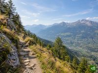
L'Alta Via di Merano compie il giro del Parco naturale Gruppo di Tessa, sopra Merano, in Alto Adige. Sul versante sud, soleggiato, passa accanto a masi di montagna ancora in attività, con vista su Merano e sulla Val Venosta, mentre sul versante nord sale in alta quota e valica il Passo Gelato. Lungo tutto l'anello si trovano locande e rifugi.
Meraner Höhenweg: la mappa
La mappa interattiva mostra tutto il percorso, con alloggi, punti acqua e trasporti pubblici lungo il cammino.
Pianificatore di percorso: Meraner Höhenweg
Crea un itinerario giorno per giorno nel pianificatore, trova alloggi lungo il percorso e scarica il file GPX. Parti da un esempio qui sotto o da zero.
6-Day ItineraryMostrato sotto
The classic six-stage round of the Texel Group nature park above Merano, walked clockwise from Hochmuth as the tourism board lays it out, with its signed detour around the closed section into the Pfossental. The first two days follow the sunny southern balcony past the Leiteralm to Giggelberg, then along the Sonnenberg farms high above the Vinschgau to Katharinaberg in the Schnalstal, with the night at a farm just above the village. Day three takes the detour down to the Tumlhof and back up the Pfossental road, then follows the valley on to the Eishof. Day four crosses the Eisjöchl, the high point of the circuit, by the Stettiner Hütte and drops through Lazins to Pfelders. The quieter eastern side above the Passeier valley then leads by Ulfas and Christl to Matatz, and the last and longest day crosses a deep side valley and climbs by Magdfeld back to Hochmuth. Mountain inns, farm stays and huts the whole way round.
Meraner Höhenweg: le tappe
6 giorni, 95 km e 5534 m di dislivello positivo. Queste tappe seguono l'itinerario «6-Day Itinerary». Aprilo nel pianificatore per dividere o unire le giornate e scegliere dove dormire.
- Tappa 113,5 km↑ 900 m · ↓ 686 m ·
5-6h con sosteHochmuth Giggelberg
Notte a Gasthof Giggelberg - Tappa 215,3 km↑ 846 m · ↓ 916 m ·
6-7h con sosteGiggelberg Katharinaberg
Notte a Untervernatschhof - Tappa 312,9 km↑ 982 m · ↓ 415 m ·
5-6h con sosteBy the Tumlhof the Eishof
Notte a Eishof - Tappa 416,9 km↑ 937 m · ↓ 1372 m ·
7-8h con sosteOver the Eisjöchl Pfelders
Notte a Hotel Pfeldererhof - Tappa 517,9 km↑ 452 m · ↓ 1024 m ·
6-7h con sosteBy Ulfas Matatz
Notte a Krusterhof - Tappa 619,0 km↑ 1417 m · ↓ 1124 m ·
8-9h con sosteBy Magdfeld Hochmuth
Quando andare
- Periodo migliore16 lug – 30 set
- Buon periodo1 lug – 15 lug
- Possibile, con attenzione1 mag – 30 giu, 1 ott – 31 ott
Il giro completo si percorre dal 1° luglio al 30 settembre, quando è aperto il Rifugio Petrarca (Stettiner Hütte) appena sotto il Passo Gelato, anche se nella prima metà di luglio sul passo può esserci ancora neve. Prima di luglio il rifugio è chiuso e il passo di solito innevato, quindi da maggio ha senso percorrere solo il versante sud, soleggiato. A ottobre il rifugio è chiuso e sono possibili le prime nevicate, e la lunga traversata dalla Val di Fosse a Plan non ha più un rifugio in quota. Per luglio e agosto conviene prenotare i rifugi per tempo.