
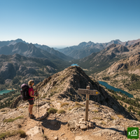
GR20
Informazioni su GR20
Il GR20, in lingua corsa Fra li Monti, segue la dorsale montuosa della Corsica da Calenzana, a nord, fino a Conca, a sud. Le tappe sono ripide e rocciose, con passaggi in cui si usano le mani e qualche tratto attrezzato con catene, soprattutto nella metà nord, fino a Vizzavona. Si dorme per lo più nei rifugi del parco naturale regionale, in camerata, in tenda a noleggio o nella propria, sempre prenotando in anticipo.
GR20: la mappa
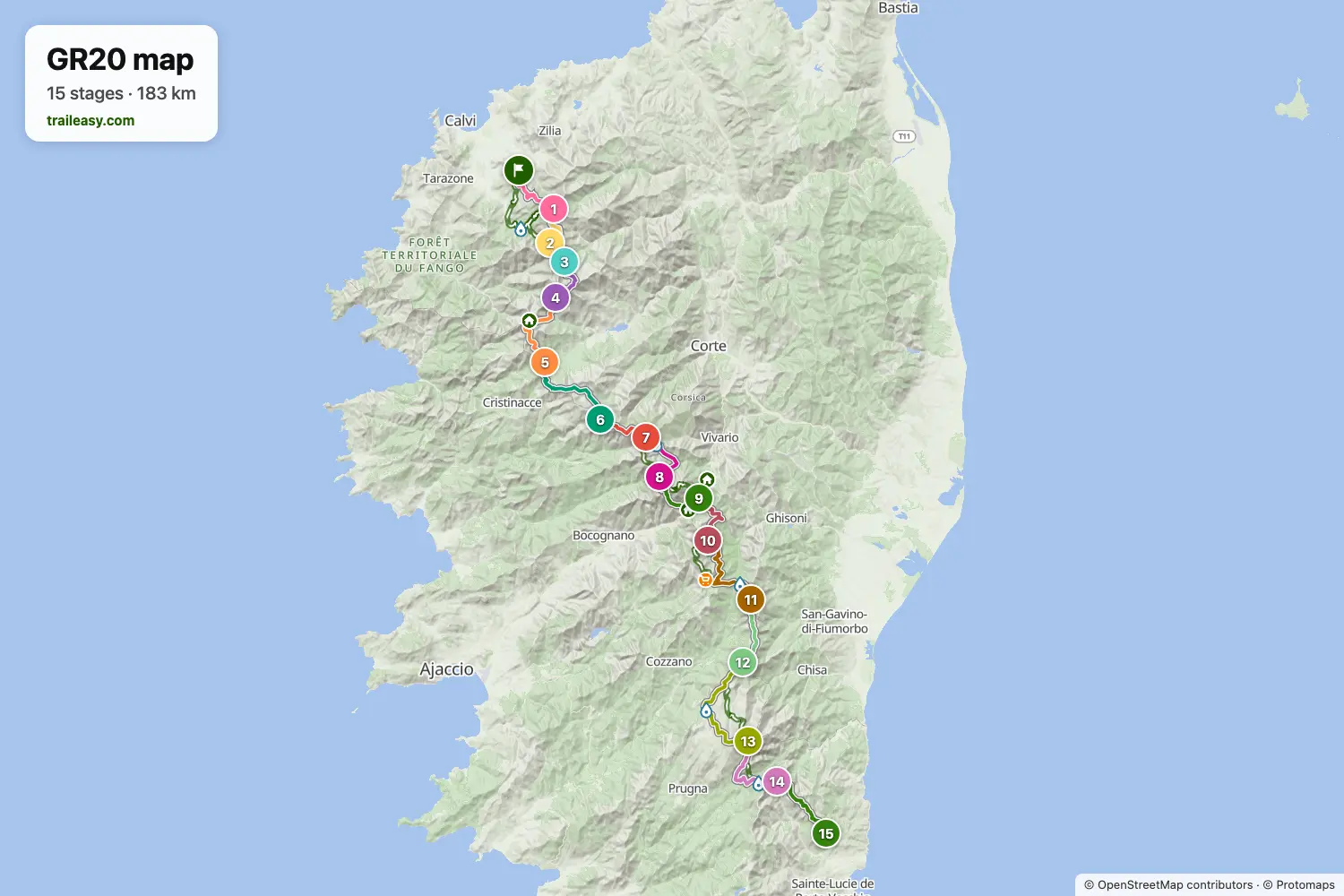
La mappa interattiva mostra tutto il percorso, con alloggi, punti acqua e trasporti pubblici lungo il cammino.
Pianificatore di percorso: GR20
Crea un itinerario giorno per giorno nel pianificatore, trova alloggi lungo il percorso e scarica il file GPX. Parti da un esempio qui sotto o da zero.
12-Day Itinerary
The GR20 from Calenzana to Conca in twelve days, for fit walkers who are ready to link some of the standard stages. After the ridge walk to Ortu di u Piobbu, the second day runs two stages together, past the suspension bridge below Refuge de Carrozzu and over the Bocca di Stagnu to Asco Stagnu. The crossing beneath Monte Cinto to Tighjettu, the laricio pines at Castel di Vergio and the lake basin at Manganu follow at the usual pace. The long day over the Brèche de Capitellu passes Petra Piana and ends at l'Onda, leaving a short stage down to Vizzavona, the halfway village on the mountain railway. In the south the route keeps the stops at Capanelle and Prati, then links the ridge past Usciolu with the Coscione plateau to reach Matalza, climbs Monte Incudine on the way to Bavella, and finishes past Paliri in Conca.
15-Day ItineraryMostrato sotto
The classic traverse of the GR20, walking north to south along the granite spine of Corsica from the Balagne village of Calenzana to Conca above the south-east coast. The northern half holds the hardest ground: the ridge walk to Ortu di u Piobbu, the swaying suspension bridge below Refuge de Carrozzu, the short but relentless climb over the Bocca di Stagnu to Asco Stagnu beneath Monte Cinto, and the high crossings above Tighjettu before the route eases into the laricio pines at Castel di Vergio. The middle days link the lake basins of Manganu, Petra Piana and l'Onda, crossing the Brèche de Capitellu high above Lac de Melo, then drop to Vizzavona, the wooded halfway village on the island's mountain railway. South of there the trail runs along broad ridges and open plateaux through Capanelle, Bocca di Verdi, Prati and Usciolu, climbs Monte Incudine on the long day to Asinao, and swings beneath the Aiguilles de Bavella to the last refuge at Paliri before the final descent into Conca. Nights are spent in the refuges, bergeries and gites hikers actually use, with the road-served stops at Asco Stagnu, Castel di Vergio and Vizzavona giving the natural resupply points.
Cosa dicono gli escursionisti verificati
GR20: le tappe
15 giorni, 188 km e 13.339 m di dislivello positivo. Queste tappe seguono l'itinerario «15-Day Itinerary». Aprilo nel pianificatore per dividere o unire le giornate e scegliere dove dormire.
- Tappa 112,1 km↑ 1530 m · ↓ 208 m ·
5-6h con sosteCalenzana Refuge d'Ortu di u Piobbu
Notte a Refuge d'Ortu di u Piobbu - Tappa 27,7 km↑ 792 m · ↓ 1079 m ·
4-5h con sosteRefuge d'Ortu di u Piobbu Refuge de Carrozzu
Notte a Refuge de Carozzu - Tappa 35,5 km↑ 860 m · ↓ 709 m ·
3-4h con sosteRefuge de Carrozzu Asco Stagnu
Notte a Hôtel Le Chalet - Tappa 48,7 km↑ 1248 m · ↓ 984 m ·
5-6h con sosteAsco Stagnu Refuge de Tighjettu
Notte a Refuge Tighiettu - Tappa 515,2 km↑ 859 m · ↓ 1140 m ·
6-7h con sosteRefuge de Tighjettu Castel di Vergio
Notte a Hôtel Castel de Vergio - Tappa 616,0 km↑ 696 m · ↓ 495 m ·
5-6h con sosteCastel di Vergio Refuge de Manganu
Notte a Refuge de Manganu - Tappa 78,7 km↑ 884 m · ↓ 642 m ·
4-5h con sosteRefuge de Manganu Refuge de Petra Piana
Notte a Refuge Petra Piana - Tappa 810,0 km↑ 477 m · ↓ 926 m ·
4-5h con sosteRefuge de Petra Piana Refuge de l'Onda
Notte a Refuge de l'Onda - Tappa 911,1 km↑ 777 m · ↓ 1215 m ·
5-6h con sosteRefuge de l'Onda Vizzavona
Notte a Hôtel-Restaurant U Castellu - Tappa 1013,9 km↑ 1054 m · ↓ 416 m ·
5-6h con sosteVizzavona E Capanelle
Notte a Bergeries de E Capanelle - Gîte U Fugone - Tappa 1117,8 km↑ 1098 m · ↓ 881 m ·
7-8h con sosteE Capanelle Refuge de Prati
Notte a Refuge de Prati - Tappa 1211,1 km↑ 839 m · ↓ 914 m ·
5-6h con sosteRefuge de Prati Refuge d'Usciolu
Notte a Refuge d'Usciolu - Tappa 1320,9 km↑ 1077 m · ↓ 1279 m ·
8-9h con sosteRefuge d'Usciolu Refuge d'Asinao
Notte a Refuge d’Asinau - Tappa 1415,6 km↑ 732 m · ↓ 1216 m ·
6-7h con sosteRefuge d'Asinao Refuge de Paliri
Notte a Refuge Paliri - Tappa 1513,7 km↑ 416 m · ↓ 1244 m ·
5-6h con sosteRefuge de Paliri Conca
Quando andare
- Periodo migliore16 giu – 30 set
- Possibile, con attenzione1 giu – 15 giu, 1 ott – 15 ott
La stagione di cammino va da metà giugno a fine settembre, con i rifugi custoditi aperti da metà maggio a inizio ottobre. Luglio e agosto portano le condizioni più affidabili insieme a un caldo feroce e ai rifugi pieni, mentre fine giugno e inizio settembre sono più freschi e molto più tranquilli. A inizio giugno i valichi settentrionali possono ancora trattenere neve, e i posti vanno via appena apre la stagione. Da ottobre i rifugi restano senza custode, senza pasti né rifornimenti in alcun punto dei tratti alti.