
Coast to Coast Walk
Informazioni su Coast to Coast Walk
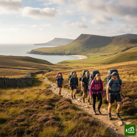
La traversata dell'Inghilterra settentrionale ideata da Alfred Wainwright, da St Bees, sul mare d'Irlanda, a Robin Hood's Bay, sul mare del Nord. Passa per tre parchi nazionali, dalle montagne del Lake District alle brughiere dei North York Moors, valicando i Monti Pennini a Nine Standards Rigg e attraversando Swaledale, negli Yorkshire Dales. Per tradizione si bagnano gli scarponi in mare alla partenza e all'arrivo.
Coast to Coast Walk: la mappa
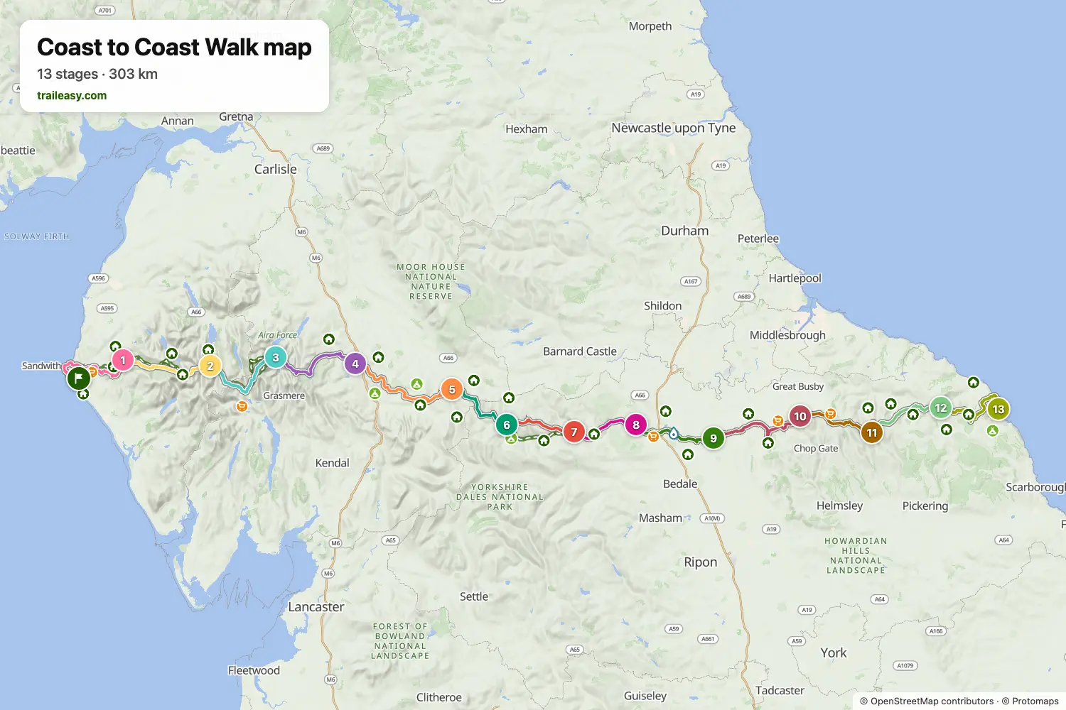
La mappa interattiva mostra tutto il percorso, con alloggi, punti acqua e trasporti pubblici lungo il cammino.
Pianificatore di percorso: Coast to Coast Walk
Crea un itinerario giorno per giorno nel pianificatore, trova alloggi lungo il percorso e scarica il file GPX. Parti da un esempio qui sotto o da zero.
13 Days - Coast to Coast WalkMostrato sotto
A classic crossing of northern England from the Irish Sea at St Bees to the North Sea at Robin Hood's Bay, covering 297km in 13 stages. The route traverses three national parks — the Lake District, the Yorkshire Dales, and the North York Moors — taking in dramatic mountain passes including Greenup Edge and Grisedale Tarn, the wild moorland of Kidsty Pike, and the iconic Lion Inn on Blakey Ridge. This split balances mountain days in the Lakes with rolling Dales stages and a memorable final stretch across the North York Moors to the sea.
16-Day Itinerary
The Coast to Coast Walk from St Bees to Robin Hood's Bay in sixteen days, a gentler split that cuts three long stages of the shorter plans in two. In the Lake District it breaks the crossing from Borrowdale to Patterdale with a night in Grasmere, which leaves a short day over Grisedale Hause and time for the fells above it. A night in Orton does the same between Shap and Kirkby Stephen. The Dales stages run as usual through Keld, Reeth and Richmond, and the Vale of Mowbray is crossed in two days to Ingleby Cross. On the North York Moors the walk stops at Beak Hills Farm, short of the Wainstones, and at the Lion Inn on Blakey Ridge before the last two stages to Grosmont and the sea.
Coast to Coast Walk: le tappe
13 giorni, 299 km e 7986 m di dislivello positivo. Queste tappe seguono l'itinerario «13 Days - Coast to Coast Walk». Aprilo nel pianificatore per dividere o unire le giornate e scegliere dove dormire.
- Tappa 125,8 km↑ 806 m · ↓ 713 m ·
8-9h con sosteVerso Ennerdale
Notte a Fox and Hounds Inn - Tappa 223,7 km↑ 606 m · ↓ 614 m ·
8-9h con sosteEnnerdale Borrowdale
Notte a YHA Borrowdale - Tappa 324,6 km↑ 1153 m · ↓ 1099 m ·
9-10h con sosteBorrowdale Patterdale
Notte a Patterdale Hotel - Tappa 425,8 km↑ 999 m · ↓ 898 m ·
9-10h con sostePatterdale Shap
Notte a The Greyhound Hotel, Bar & Restaurant - Tappa 531,1 km↑ 656 m · ↓ 735 m ·
10-11h con sosteShap Kirkby Stephen
Notte a Black Bull - Tappa 618,4 km↑ 606 m · ↓ 445 m ·
6-7h con sosteKirkby Stephen Keld
Notte a Keld Lodge - Tappa 717,9 km↑ 576 m · ↓ 707 m ·
6-7h con sosteKeld Reeth
Notte a The Buck - Tappa 816,7 km↑ 347 m · ↓ 419 m ·
5-6h con sosteReeth Richmond
Notte a The Kings Head Hotel - Tappa 922,5 km↑ 145 m · ↓ 242 m ·
6-7h con sosteRichmond Danby Wiske
Notte a Rectory House Bed and breakfast - Tappa 1027,8 km↑ 666 m · ↓ 411 m ·
9-10h con sosteDanby Wiske Lordstones
Notte a Lord Stones Country Park - Tappa 1119,6 km↑ 598 m · ↓ 496 m ·
6-7h con sosteLordstones Blakey Ridge
Notte a The Lion Inn, Blakey Ridge - Tappa 1221,5 km↑ 228 m · ↓ 580 m ·
6-7h con sosteBlakey Ridge Grosmont
Notte a Grosmont House Bed & Breakfast Whitby - Tappa 1323,8 km↑ 600 m · ↓ 591 m ·
8-9h con sosteGrosmont Robin Hood's Bay
Quando andare
- Periodo migliore1 apr – 30 giu, 1 set – 30 set
- Buon periodo1 mar – 31 mar, 1 lug – 31 ago, 1 ott – 31 ott
- Possibile, con attenzione1 nov – 29 feb
Da aprile a giugno e a settembre sono i mesi migliori, con i valichi del Lake District liberi e luce sufficiente per le giornate lunghe. L'attraversamento di Nine Standards Rigg ha tre itinerari stagionali pensati per proteggere la torba, quindi conviene vedere quale vale per le proprie date. Luglio e agosto sono caldi e affollati, e da novembre a febbraio le cime del Lake District sono una traversata di montagna con poca luce.