
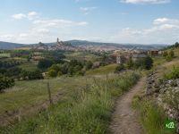
Cammino di Santiago (Via Podiensis)
Conosciuto anche come GR65
Informazioni su Cammino di Santiago (Via Podiensis)
L'itinerario giacobeo francese per eccellenza, dalla cattedrale di Le Puy-en-Velay fino ai piedi dei Pirenei a Saint-Jean-Pied-de-Port, attraverso il Velay vulcanico, l'altopiano dell'Aubrac e i causses calcarei del Quercy. È la via francese meglio attrezzata, con ostelli per pellegrini, abbazie romaniche e bastide arroccate.
Cammino di Santiago (Via Podiensis): la mappa
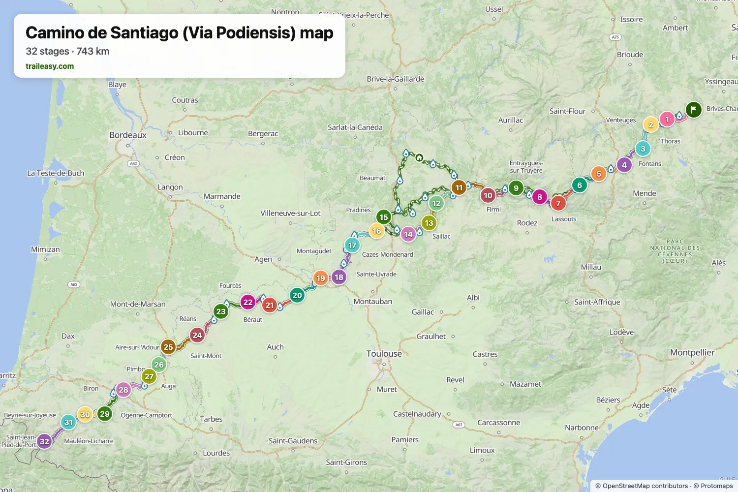
La mappa interattiva mostra tutto il percorso, con alloggi, punti acqua e trasporti pubblici lungo il cammino.
Pianificatore di percorso: Cammino di Santiago (Via Podiensis)
Crea un itinerario giorno per giorno nel pianificatore, trova alloggi lungo il percorso e scarica il file GPX. Parti da un esempio qui sotto o da zero.
32-Day ItineraryMostrato sotto
The classic French approach to Santiago, walked from the cathedral of Le Puy-en-Velay to the pilgrim gate at Saint-Jean-Pied-de-Port. It climbs straight out of Le Puy onto the volcanic Velay, crosses the empty Margeride to the Domaine du Sauvage, then traverses the Aubrac plateau to Saint-Chély before dropping into the Lot valley at Saint-Côme-d'Olt and Estaing. Conques and its abbey come mid-route, followed by Figeac, the dry limestone causses of the Quercy around Cajarc and Limogne, and Cahors on its river loop. The second half runs through the bastide country of the Gers — Lauzerte, Moissac, Auvillar, Lectoure and Condom — before the Landes and the foothills of the Basque country close it out at Navarrenx, Ostabat and the Pyrenean gateway itself. Gîtes d'étape and chambres d'hôtes line the whole way, so the days stay comfortable.
Cammino di Santiago (Via Podiensis): le tappe
32 giorni, 773 km e 16.434 m di dislivello positivo. Queste tappe seguono l'itinerario «32-Day Itinerary». Aprilo nel pianificatore per dividere o unire le giornate e scegliere dove dormire.
- Tappa 123,9 km↑ 684 m · ↓ 428 m ·
8-9h con sosteVerso Saint-Privat-d'Allier
Notte a La Cabourne - Tappa 218,9 km↑ 734 m · ↓ 648 m ·
6-7h con sosteSaint-Privat-d'Allier Saugues
Notte a Le chalet du pèlerin - Tappa 320,0 km↑ 638 m · ↓ 310 m ·
6-7h con sosteSaugues Le Sauvage
Notte a Auberge Du Sauvage In Gevaudan - Tappa 422,4 km↑ 381 m · ↓ 697 m ·
7-8h con sosteLe Sauvage Aumont-Aubrac
Notte a Hôtel les Granges de Bigose - Tappa 522,4 km↑ 492 m · ↓ 265 m ·
7-8h con sosteAumont-Aubrac Nasbinals
Notte a La Rose de l'Aubrac - Tappa 620,2 km↑ 447 m · ↓ 341 m ·
6-7h con sosteNasbinals Saint-Chély-d'Aubrac
Notte a L Annexe de l'Aubrac - Tappa 732,8 km↑ 769 m · ↓ 1681 m ·
11-12h con sosteSaint-Chély-d'Aubrac Saint-Côme-d'Olt
Notte a Accueil du Couvent de Malet - Tappa 821,8 km↑ 545 m · ↓ 624 m ·
7-8h con sosteSaint-Côme-d'Olt Estaing
Notte a gîte d'étape saint christophe - Tappa 926,0 km↑ 922 m · ↓ 733 m ·
9-10h con sosteEstaing Conques
Notte a Gîte d'Etape Domaine de Sénos sur le chemin de St-Jacques-de-Compostelle - Tappa 1026,9 km↑ 754 m · ↓ 913 m ·
9-10h con sosteConques Decazeville
Notte a Le mineur paysan - Tappa 1130,7 km↑ 789 m · ↓ 943 m ·
10-11h con sosteDecazeville Figeac
Notte a Hôtel Restaurant Le Pont D'Or Best Western - Tappa 1224,7 km↑ 637 m · ↓ 502 m ·
8-9h con sosteFigeac Cajarc
Notte a Gîte AMASSA - Tappa 1322,5 km↑ 556 m · ↓ 561 m ·
7-8h con sosteCajarc Limogne-en-Quercy
Notte a Gîte d'étape le Mas du Cartographe - Tappa 1421,8 km↑ 293 m · ↓ 308 m ·
6-7h con sosteLimogne-en-Quercy Bach
Notte a Les Yourtes de Bascot - Tappa 1523,2 km↑ 346 m · ↓ 540 m ·
7-8h con sosteBach Cahors
Notte a Logis Hôtel Chartreuse - Tappa 1616,5 km↑ 485 m · ↓ 316 m ·
5-6h con sosteCahors Lascabanes
Notte a Gîte d'étape de Trigodina - Tappa 1727,9 km↑ 505 m · ↓ 606 m ·
9-10h con sosteLascabanes Lauzerte
Notte a Auberge du Canabal - Tappa 1835,4 km↑ 770 m · ↓ 887 m ·
11-12h con sosteLauzerte Moissac
Notte a Le Moulin De Moissac, Sure Hôtel Collection by Best Western - Tappa 1912,7 km↑ 9 m · ↓ 11 m ·
3-4h con sosteMoissac Auvillar
Notte a Gîte et Aire de bivouac de l'écluse 28 - Tappa 2023,7 km↑ 495 m · ↓ 355 m ·
7-8h con sosteAuvillar Lectoure
Notte a Gîte Chambre D’hôte Chez Vous Chez Nous - Tappa 2124,9 km↑ 444 m · ↓ 483 m ·
8-9h con sosteLectoure Condom
Notte a Le Chemin Tables - Tappa 2223,9 km↑ 499 m · ↓ 594 m ·
7-8h con sosteCondom Éauze
Notte a Continental - Tappa 2325,7 km↑ 446 m · ↓ 361 m ·
8-9h con sosteÉauze Manciet
Notte a Gîte le Mille bornes - Tappa 2429,4 km↑ 387 m · ↓ 451 m ·
9-10h con sosteManciet Nogaro
Notte a Logis Hôtel Solenca - Tappa 2528,8 km↑ 300 m · ↓ 314 m ·
8-9h con sosteNogaro Aire-sur-l'Adour
Notte a Les Platanes - Tappa 2618,8 km↑ 248 m · ↓ 110 m ·
5-6h con sosteAire-sur-l'Adour Miramont-Sensacq
Notte a La Maison du Bos - Tappa 2717,5 km↑ 354 m · ↓ 338 m ·
5-6h con sosteMiramont-Sensacq Arzacq-Arraziguet
Notte a Gite l'Arzacquois/ Centre d'Accueil - Tappa 2829,7 km↑ 507 m · ↓ 531 m ·
9-10h con sosteArzacq-Arraziguet Arthez-de-Béarn
Notte a Gîte de la Boulangerie Broussé - Tappa 2932,9 km↑ 528 m · ↓ 614 m ·
10-11h con sosteArthez-de-Béarn Navarrenx
Notte a Hôtel Restaurant Le Commerce - Tappa 3019,7 km↑ 313 m · ↓ 308 m ·
6-7h con sosteNavarrenx Aroue
Notte a Gîte communal d'Aroue - Tappa 3120,7 km↑ 588 m · ↓ 568 m ·
7-8h con sosteAroue Ostabat-Asme
Notte a Gîte d'étape Etchetoa - Tappa 3226,6 km↑ 569 m · ↓ 554 m ·
8-9h con sosteOstabat-Asme Saint-Jean-Pied-de-Port
Quando andare
- Periodo migliore1 mag – 30 giu, 1 set – 15 ott
- Buon periodo1 apr – 30 apr, 1 lug – 31 ago
- Possibile, con attenzione16 ott – 31 mar
Maggio, giugno e settembre fino ai primi di ottobre sono i mesi migliori, quando i gîtes sono aperti, la luce è lunga e il tempo si stabilizza. La stagione va da metà aprile circa a metà ottobre, e ogni estremità porta un rischio: l'altopiano dell'Aubrac può trattenere neve e nubi basse ad aprile, mentre molti gîtes chiudono per l'inverno da metà ottobre. La piena estate pone il problema opposto, perché i causses del Quercy e la campagna di Guascogna non offrono quasi ombra.