
Adlerweg
Conosciuto anche come Eagle Walk
Informazioni su Adlerweg
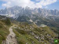
L'Adlerweg disegna la sagoma di un'aquila in volo attraverso il Tirolo, una lunga traversata da est a ovest dal Wilder Kaiser all'Arlberg. Collega le torri calcaree del Karwendel a rifugi d'alta quota, tranquilli pascoli alpini e ai valichi delle Alpi del Lechtal, passando per Innsbruck.
Adlerweg: la mappa
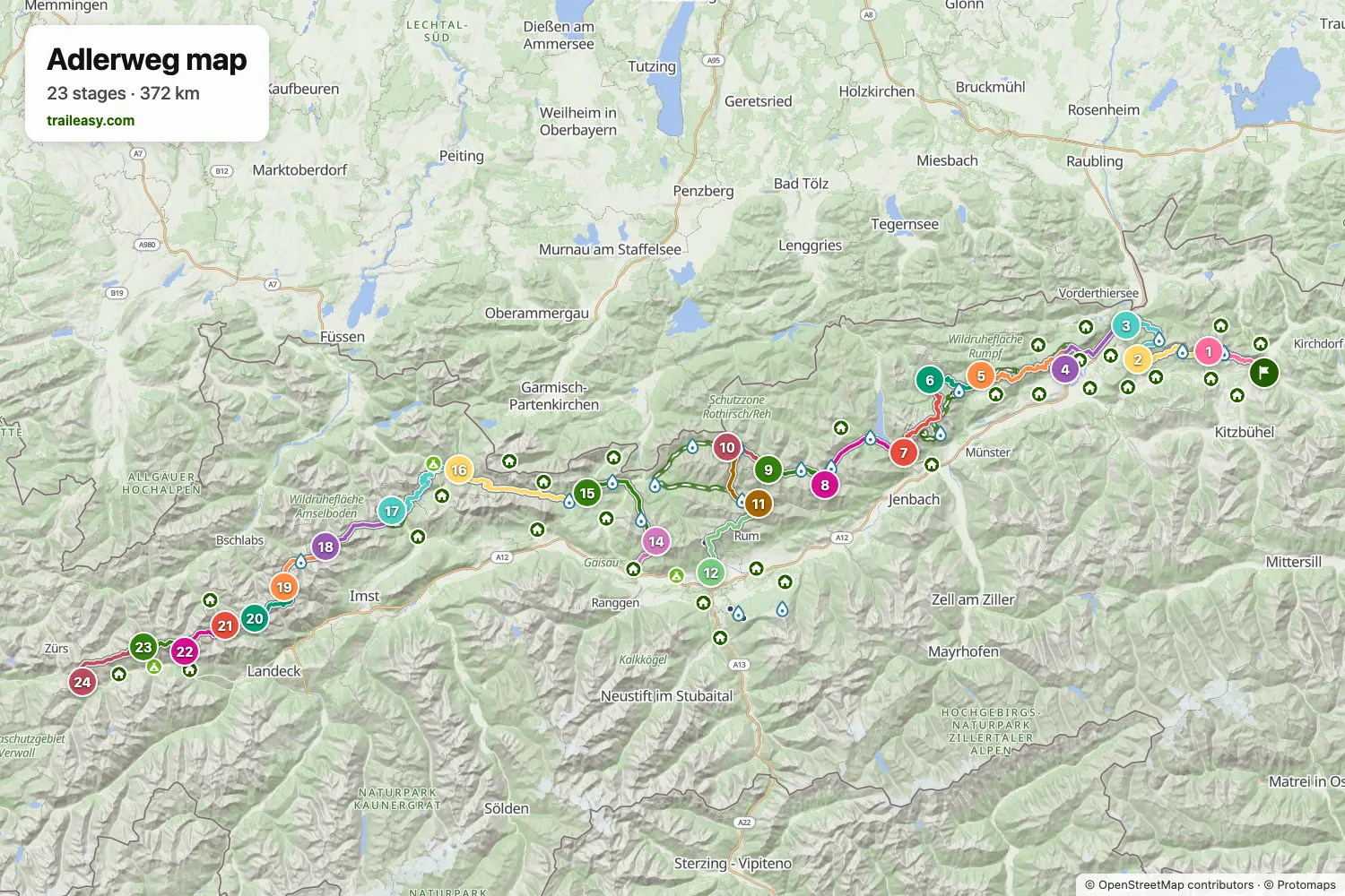
La mappa interattiva mostra tutto il percorso, con alloggi, punti acqua e trasporti pubblici lungo il cammino.
Pianificatore di percorso: Adlerweg
Crea un itinerario giorno per giorno nel pianificatore, trova alloggi lungo il percorso e scarica il file GPX. Parti da un esempio qui sotto o da zero.
24-Day ItineraryMostrato sotto
The classic east to west traverse of the Tyrol, from St. Johann in Tirol under the Wilder Kaiser to St. Christoph am Arlberg. The walk works through the Kaiser and Brandenberg hills to Kufstein and Achensee, crosses the heart of the Karwendel on a run of high huts, drops into Innsbruck for a city day on the Zirbenweg, then climbs back out over the Solstein and the Mieminger range to finish on the long chain of Lechtal Alps huts.
Adlerweg: le tappe
24 giorni, 363 km e 25.059 m di dislivello positivo. Queste tappe seguono l'itinerario «24-Day Itinerary». Aprilo nel pianificatore per dividere o unire le giornate e scegliere dove dormire.
- Tappa 112,7 km↑ 1087 m · ↓ 483 m ·
5-6h con sosteSt. Johann in Tirol the Gaudeamushütte
Notte a Gaudeamushütte - Kaiser Mountains - Tappa 215,0 km↑ 731 m · ↓ 1098 m ·
6-7h con sostethe Gaudeamushütte Through the Kaiser foothills
Notte a Pension-Biobauernhof Hagenhof - Tappa 315,1 km↑ 752 m · ↓ 1165 m ·
6-7h con sosteThrough the Kaiser foothills Kufstein
Notte a Auracher Löchl - Tappa 417,8 km↑ 1240 m · ↓ 1162 m ·
7-8h con sosteKufstein the Buchacker ridge
Notte a Hotel Kammerhof - Tappa 523,9 km↑ 2123 m · ↓ 2001 m ·
11-12h con sostethe Buchacker ridge Brandenberg
Notte a Gwercherwirt - Tappa 619,7 km↑ 1107 m · ↓ 779 m ·
7-8h con sosteBrandenberg Steinberg am Rofan
Notte a Mesnerhof - C Tirol - Tappa 721,0 km↑ 1501 m · ↓ 1562 m ·
9-10h con sosteAcross the Rofan the Achensee
Notte a Wellnessresidenz Alpenrose - Tappa 817,2 km↑ 1046 m · ↓ 43 m ·
6-7h con sosteInto the Karwendel the Lamsenjochhütte
Notte a Lamsenjochhütte - Tappa 912,2 km↑ 800 m · ↓ 909 m ·
5-6h con sosteLamsenjochhütte the Falkenhütte
Notte a Falkenhütte - Tappa 108,8 km↑ 425 m · ↓ 503 m ·
3-4h con sosteUnder the Laliderer walls the Karwendelhaus
Notte a Karwendelhaus in Karwendel - Tappa 1114,5 km↑ 1479 m · ↓ 1474 m ·
7-8h con sosteKarwendelhaus the Hallerangeralm
Notte a HallerangerAlm - Tappa 1221,8 km↑ 1186 m · ↓ 2383 m ·
9-10h con sosteOver the Nordkette down Innsbruck
Notte a Hotel Das Innsbruck - Tappa 130,0 km↑ 0 m · ↓ 0 m
Innsbruck Zirl up
Notte a Hotel Das Innsbruck - Tappa 148,7 km↑ 1213 m · ↓ 30 m ·
4-5h con sosteZirl up the Solsteinhaus
Notte a Solsteinhaus - Tappa 1519,1 km↑ 831 m · ↓ 1515 m ·
7-8h con sosteSolsteinhaus Leutasch
Notte a Hotel Quellenhof Leutasch - Tappa 1624,1 km↑ 602 m · ↓ 731 m ·
8-9h con sosteThrough the Gaistal Ehrwald
Notte a der Grüne Baum Mountain und Boutiquehotel - Tappa 1727,2 km↑ 2291 m · ↓ 1258 m ·
11-12h con sosteInto the Mieminger range the Loreahütte
Notte a Lorea Hütte - Tappa 1816,1 km↑ 1247 m · ↓ 1230 m ·
7-8h con sosteLoreahütte the Anhalter Hütte
Notte a Anhalter Hütte - Tappa 1912,4 km↑ 791 m · ↓ 906 m ·
5-6h con sosteAnhalter Hütte the Hanauer Hütte
Notte a Hanauer Hütte - Tappa 2011,2 km↑ 1280 m · ↓ 972 m ·
5-6h con sosteOver the Dremelscharte the Württemberger Haus
Notte a Württemberger Haus - Tappa 217,0 km↑ 668 m · ↓ 650 m ·
3-4h con sosteWürttemberger Haus the Memminger Hütte
Notte a Memminger Hütte - Tappa 2211,0 km↑ 1209 m · ↓ 1074 m ·
5-6h con sosteMemminger Hütte the Ansbacher Hütte
Notte a Ansbacher Hütte - Tappa 238,4 km↑ 535 m · ↓ 604 m ·
3-4h con sosteAnsbacher Hütte the Kaiserjochhaus
Notte a Kaiserjochhaus - Tappa 2417,6 km↑ 915 m · ↓ 1439 m ·
7-8h con sosteLast ridges St. Christoph am Arlberg
Quando andare
- Periodo migliore1 lug – 15 set
- Buon periodo16 giu – 30 giu
- Possibile, con attenzione16 set – 30 set
Da luglio a metà settembre è il periodo affidabile, con i rifugi aperti e le traversate libere. A fine giugno la neve vecchia resta sui valichi più alti e rende molto più scomodi i ghiaioni e i tratti attrezzati del Karwendel e del Lechtal. Dalla seconda metà di settembre i rifugi chiudono e proseguire significa lunghe deviazioni verso gli alloggi di fondovalle.