
John Muir Way
À propos de John Muir Way
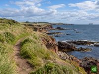
Le John Muir Way traverse l'Écosse d'une côte à l'autre, de Helensburgh, sur le Firth of Clyde, jusqu'à Dunbar, sur la mer du Nord, ville natale de John Muir, pionnier de la protection de la nature. Il franchit les landes qui dominent le Loch Lomond, suit les anciens canaux le long du mur d'Antonin jusqu'à la Falkirk Wheel, passe au pied des ponts du Forth, traverse Édimbourg de part en part et s'achève sur les plages et les falaises de l'East Lothian.
John Muir Way : la carte
La carte interactive montre tout le parcours, avec les hébergements, les points d'eau et les transports en commun le long du chemin.
Planificateur d'itinéraire John Muir Way
Créez un itinéraire jour par jour dans le planificateur, trouvez des hébergements le long du parcours et téléchargez le fichier GPX. Partez d'un exemple ci-dessous ou de zéro.
10-Day ItineraryAffiché ci-dessous
The John Muir Way walked coast to coast in ten days on its ten official sections, from the start plinth on Helensburgh's waterfront to John Muir's Birthplace in Dunbar, with a few overnights shifted a little along the trail so that no day is far harder than the rest. The first day climbs over Gouk Hill for the first views of Loch Lomond, drops to Balloch and carries on through Balloch Castle Country Park to stop just beyond the town. That takes some of the weight off the second day, the crossing of the Kilpatrick Hills to Strathblane, which is the highest and most remote ground of the whole route and still the longest day. From there the walking eases onto the Strathkelvin Railway Path and the Forth and Clyde Canal, over the Roman fort on Bar Hill to Auchinstarry Marina, then along the Antonine Wall over Croy Hill and past Rough Castle to the Falkirk Wheel. Beyond Falkirk the Way passes Callendar House, follows the Union Canal and the River Avon to Linlithgow Bridge and climbs Fishers' Brae above Linlithgow, so the next morning starts in Kinneil Estate and Bo'ness before the Forth shore leads past Blackness Castle and Hopetoun to the three bridges at South Queensferry. Edinburgh comes by Cramond, Corstorphine Hill, the Water of Leith and the Union Canal. The last three days run out along the East Lothian coast through Musselburgh to Port Seton, by Aberlady, Gullane and Dirleton to North Berwick, then inland by East Linton and the River Tyne and back to the sea at John Muir Country Park for the finish.
John Muir Way : les étapes
10 jours, 216 km et 2 360 m de dénivelé positif. Ces étapes suivent l'itinéraire « 10-Day Itinerary ». Ouvrez-le dans le planificateur pour couper ou fusionner des journées et choisir où dormir.
- Étape 118,4 km↑ 454 m · ↓ 386 m ·
6–7h avec pausesVers Balloch
Nuit à Westertonhill Holiday Lodges - Étape 226,2 km↑ 490 m · ↓ 486 m ·
8–9h avec pausesBalloch Strathblane
Nuit à Kirkhouse Inn - Étape 321,6 km↑ 163 m · ↓ 191 m ·
6–7h avec pausesStrathblane Auchinstarry
Nuit à The Boathouse Hotel Bar & Restaurant - Étape 419,2 km↑ 258 m · ↓ 203 m ·
5–6h avec pausesAuchinstarry Falkirk
Nuit à Spoke'n'Boot Camping Pods - Étape 518,9 km↑ 212 m · ↓ 218 m ·
5–6h avec pausesFalkirk Linlithgow
Nuit à Wester Muirhouse - Étape 620,8 km↑ 109 m · ↓ 202 m ·
6–7h avec pausesLinlithgow South Queensferry
Nuit à Orocco Pier Hotel - Étape 724,1 km↑ 305 m · ↓ 238 m ·
7–8h avec pausesSouth Queensferry Edinburgh
Nuit à Castle Park Guest House - Étape 820,7 km↑ 75 m · ↓ 141 m ·
6–7h avec pausesEdinburgh Port Seton
Nuit à Anchorage B&B - Étape 921,4 km↑ 85 m · ↓ 84 m ·
6–7h avec pausesPort Seton North Berwick
Nuit à Marine & Lawn North Berwick - Étape 1025,1 km↑ 209 m · ↓ 200 m ·
7–8h avec pausesNorth Berwick Dunbar
Quand partir
- Meilleure période1 avr. – 30 juin, 1 sept. – 30 sept.
- Bonne période1 mars – 31 mars, 1 juil. – 31 août, 1 oct. – 31 oct.
- Possible, avec prudence1 nov. – 29 févr.
Praticable toute l'année : l'itinéraire reste bas de bout en bout et rarement loin d'une ville ou d'une gare. Avril, mai et juin sont les mois les plus secs et les plus ensoleillés, et septembre devient plus calme une fois les vacances d'été terminées. Juillet et août sont plus pluvieux, surtout à l'ouest, et mieux vaut réserver tôt à Édimbourg pour le mois d'août, celui de ses festivals. De novembre à février, il ne fait jour qu'environ sept heures, trop peu pour la longue traversée des Kilpatrick Hills, et les tempêtes d'hiver frappent la côte de l'East Lothian.