
Meraner Höhenweg
También conocido como Alta Via di Merano
Sobre Meraner Höhenweg
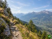
El Meraner Höhenweg rodea el parque natural del grupo de Texel, por encima de Merano, en el Tirol del Sur. Por la soleada vertiente sur pasa junto a granjas de montaña todavía en activo, con vistas sobre Merano y el Val Venosta, y por la norte se adentra en la alta montaña hasta cruzar el Eisjöchl. Hay posadas y refugios a lo largo de todo el circuito.
Meraner Höhenweg: mapa
El mapa interactivo muestra toda la ruta, con alojamientos, puntos de agua y transporte público a lo largo del camino.
Planificador de ruta: Meraner Höhenweg
Crea un itinerario día a día en el planificador de ruta, encuentra alojamientos a lo largo de la ruta y descarga el archivo GPX. Empieza con un ejemplo abajo o desde cero.
6-Day ItineraryMostrado abajo
The classic six-stage round of the Texel Group nature park above Merano, walked clockwise from Hochmuth as the tourism board lays it out, with its signed detour around the closed section into the Pfossental. The first two days follow the sunny southern balcony past the Leiteralm to Giggelberg, then along the Sonnenberg farms high above the Vinschgau to Katharinaberg in the Schnalstal, with the night at a farm just above the village. Day three takes the detour down to the Tumlhof and back up the Pfossental road, then follows the valley on to the Eishof. Day four crosses the Eisjöchl, the high point of the circuit, by the Stettiner Hütte and drops through Lazins to Pfelders. The quieter eastern side above the Passeier valley then leads by Ulfas and Christl to Matatz, and the last and longest day crosses a deep side valley and climbs by Magdfeld back to Hochmuth. Mountain inns, farm stays and huts the whole way round.
Meraner Höhenweg: etapas
6 días, 95 km y 5534 m de desnivel positivo. Estas etapas siguen el itinerario «6-Day Itinerary». Ábrelo en el planificador para dividir o unir días y elegir dónde dormir.
- Etapa 113,5 km↑ 900 m · ↓ 686 m ·
5-6h con paradasHochmuth Giggelberg
Noche en Gasthof Giggelberg - Etapa 215,3 km↑ 846 m · ↓ 916 m ·
6-7h con paradasGiggelberg Katharinaberg
Noche en Untervernatschhof - Etapa 312,9 km↑ 982 m · ↓ 415 m ·
5-6h con paradasBy the Tumlhof the Eishof
Noche en Eishof - Etapa 416,9 km↑ 937 m · ↓ 1372 m ·
7-8h con paradasOver the Eisjöchl Pfelders
Noche en Hotel Pfeldererhof - Etapa 517,9 km↑ 452 m · ↓ 1024 m ·
6-7h con paradasBy Ulfas Matatz
Noche en Krusterhof - Etapa 619,0 km↑ 1417 m · ↓ 1124 m ·
8-9h con paradasBy Magdfeld Hochmuth
Cuándo ir
- Mejor época16 jul – 30 sept
- Buena época1 jul – 15 jul
- Posible, con precaución1 may – 30 jun, 1 oct – 31 oct
La vuelta completa se puede hacer del 1 de julio al 30 de septiembre, mientras está abierta la Stettiner Hütte, justo debajo del Eisjöchl, aunque en la primera quincena de julio todavía puede quedar nieve en el collado. Antes de julio el refugio está cerrado y el collado suele seguir nevado, así que desde mayo solo tiene sentido recorrer la soleada vertiente sur. En octubre el refugio ya ha cerrado y son posibles las primeras nevadas, de modo que la larga travesía del Pfossental a Pfelders no tiene refugio arriba. Reserva los refugios con antelación para julio y agosto.