
John Muir Way
Sobre John Muir Way
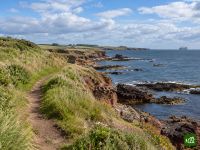
El John Muir Way cruza Escocia de costa a costa, desde Helensburgh, en el Firth of Clyde, hasta Dunbar, en el mar del Norte, la ciudad natal del naturalista John Muir. Atraviesa los páramos que se alzan sobre el lago Lomond, sigue los antiguos canales junto al muro de Antonino hasta la Falkirk Wheel, pasa al pie de los puentes del Forth, cruza Edimburgo de lado a lado y termina entre las playas y los acantilados de East Lothian.
John Muir Way: mapa
El mapa interactivo muestra toda la ruta, con alojamientos, puntos de agua y transporte público a lo largo del camino.
Planificador de ruta: John Muir Way
Crea un itinerario día a día en el planificador de ruta, encuentra alojamientos a lo largo de la ruta y descarga el archivo GPX. Empieza con un ejemplo abajo o desde cero.
10-Day ItineraryMostrado abajo
The John Muir Way walked coast to coast in ten days on its ten official sections, from the start plinth on Helensburgh's waterfront to John Muir's Birthplace in Dunbar, with a few overnights shifted a little along the trail so that no day is far harder than the rest. The first day climbs over Gouk Hill for the first views of Loch Lomond, drops to Balloch and carries on through Balloch Castle Country Park to stop just beyond the town. That takes some of the weight off the second day, the crossing of the Kilpatrick Hills to Strathblane, which is the highest and most remote ground of the whole route and still the longest day. From there the walking eases onto the Strathkelvin Railway Path and the Forth and Clyde Canal, over the Roman fort on Bar Hill to Auchinstarry Marina, then along the Antonine Wall over Croy Hill and past Rough Castle to the Falkirk Wheel. Beyond Falkirk the Way passes Callendar House, follows the Union Canal and the River Avon to Linlithgow Bridge and climbs Fishers' Brae above Linlithgow, so the next morning starts in Kinneil Estate and Bo'ness before the Forth shore leads past Blackness Castle and Hopetoun to the three bridges at South Queensferry. Edinburgh comes by Cramond, Corstorphine Hill, the Water of Leith and the Union Canal. The last three days run out along the East Lothian coast through Musselburgh to Port Seton, by Aberlady, Gullane and Dirleton to North Berwick, then inland by East Linton and the River Tyne and back to the sea at John Muir Country Park for the finish.
John Muir Way: etapas
10 días, 216 km y 2360 m de desnivel positivo. Estas etapas siguen el itinerario «10-Day Itinerary». Ábrelo en el planificador para dividir o unir días y elegir dónde dormir.
- Etapa 118,4 km↑ 454 m · ↓ 386 m ·
6-7h con paradasHacia Balloch
Noche en Westertonhill Holiday Lodges - Etapa 226,2 km↑ 490 m · ↓ 486 m ·
8-9h con paradasBalloch Strathblane
Noche en Kirkhouse Inn - Etapa 321,6 km↑ 163 m · ↓ 191 m ·
6-7h con paradasStrathblane Auchinstarry
Noche en The Boathouse Hotel Bar & Restaurant - Etapa 419,2 km↑ 258 m · ↓ 203 m ·
5-6h con paradasAuchinstarry Falkirk
Noche en Spoke'n'Boot Camping Pods - Etapa 518,9 km↑ 212 m · ↓ 218 m ·
5-6h con paradasFalkirk Linlithgow
Noche en Wester Muirhouse - Etapa 620,8 km↑ 109 m · ↓ 202 m ·
6-7h con paradasLinlithgow South Queensferry
Noche en Orocco Pier Hotel - Etapa 724,1 km↑ 305 m · ↓ 238 m ·
7-8h con paradasSouth Queensferry Edinburgh
Noche en Castle Park Guest House - Etapa 820,7 km↑ 75 m · ↓ 141 m ·
6-7h con paradasEdinburgh Port Seton
Noche en Anchorage B&B - Etapa 921,4 km↑ 85 m · ↓ 84 m ·
6-7h con paradasPort Seton North Berwick
Noche en Marine & Lawn North Berwick - Etapa 1025,1 km↑ 209 m · ↓ 200 m ·
7-8h con paradasNorth Berwick Dunbar
Cuándo ir
- Mejor época1 abr – 30 jun, 1 sept – 30 sept
- Buena época1 mar – 31 mar, 1 jul – 31 ago, 1 oct – 31 oct
- Posible, con precaución1 nov – 29 feb
Se puede recorrer todo el año: va siempre por terreno bajo y rara vez lejos de un pueblo o de una estación. Abril, mayo y junio son los meses más secos y soleados, y en septiembre hay menos gente cuando terminan las vacaciones de verano. Julio y agosto son más lluviosos, sobre todo en el extremo occidental, y en agosto, el mes de sus festivales, conviene reservar pronto en Edimburgo. De noviembre a febrero la luz del día se reduce a unas siete horas, poco para la larga travesía de las Kilpatrick Hills, y los temporales de invierno azotan la costa de East Lothian.