
GR20
Sobre GR20
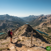
El GR20, Fra li Monti en corso, recorre la espina dorsal montañosa de Córcega desde Calenzana, al norte, hasta Conca, al sur. Las etapas son empinadas y rocosas, con trepadas y algunos pasos equipados con cadenas, sobre todo en la mitad norte, hasta Vizzavona. La mayoría de las noches se pasan en los refugios del parque natural regional, en litera, en tienda de alquiler o en la propia, siempre con reserva.
GR20: mapa
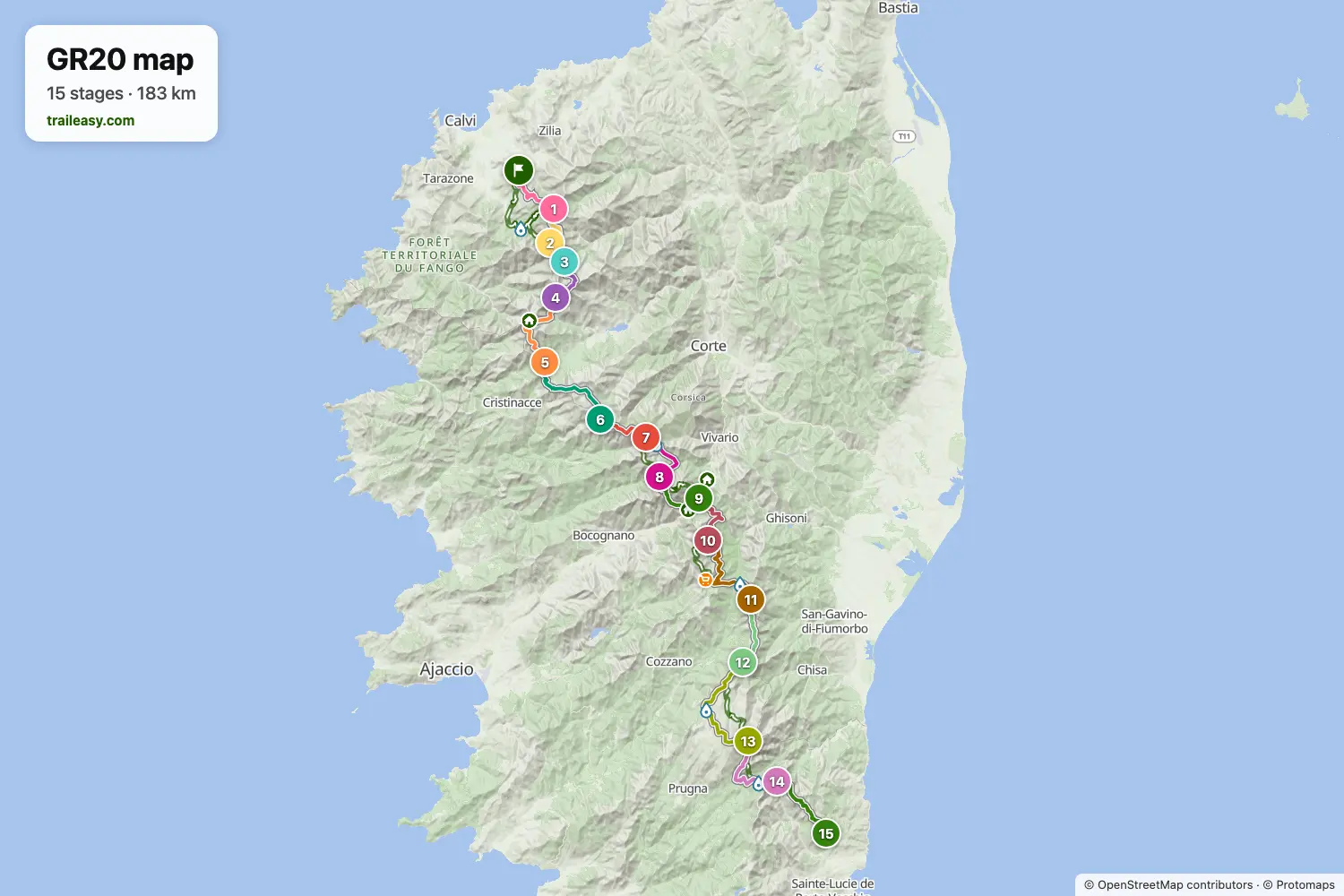
El mapa interactivo muestra toda la ruta, con alojamientos, puntos de agua y transporte público a lo largo del camino.
Planificador de ruta: GR20
Crea un itinerario día a día en el planificador de ruta, encuentra alojamientos a lo largo de la ruta y descarga el archivo GPX. Empieza con un ejemplo abajo o desde cero.
12-Day Itinerary
The GR20 from Calenzana to Conca in twelve days, for fit walkers who are ready to link some of the standard stages. After the ridge walk to Ortu di u Piobbu, the second day runs two stages together, past the suspension bridge below Refuge de Carrozzu and over the Bocca di Stagnu to Asco Stagnu. The crossing beneath Monte Cinto to Tighjettu, the laricio pines at Castel di Vergio and the lake basin at Manganu follow at the usual pace. The long day over the Brèche de Capitellu passes Petra Piana and ends at l'Onda, leaving a short stage down to Vizzavona, the halfway village on the mountain railway. In the south the route keeps the stops at Capanelle and Prati, then links the ridge past Usciolu with the Coscione plateau to reach Matalza, climbs Monte Incudine on the way to Bavella, and finishes past Paliri in Conca.
15-Day ItineraryMostrado abajo
The classic traverse of the GR20, walking north to south along the granite spine of Corsica from the Balagne village of Calenzana to Conca above the south-east coast. The northern half holds the hardest ground: the ridge walk to Ortu di u Piobbu, the swaying suspension bridge below Refuge de Carrozzu, the short but relentless climb over the Bocca di Stagnu to Asco Stagnu beneath Monte Cinto, and the high crossings above Tighjettu before the route eases into the laricio pines at Castel di Vergio. The middle days link the lake basins of Manganu, Petra Piana and l'Onda, crossing the Brèche de Capitellu high above Lac de Melo, then drop to Vizzavona, the wooded halfway village on the island's mountain railway. South of there the trail runs along broad ridges and open plateaux through Capanelle, Bocca di Verdi, Prati and Usciolu, climbs Monte Incudine on the long day to Asinao, and swings beneath the Aiguilles de Bavella to the last refuge at Paliri before the final descent into Conca. Nights are spent in the refuges, bergeries and gites hikers actually use, with the road-served stops at Asco Stagnu, Castel di Vergio and Vizzavona giving the natural resupply points.
Lo que dicen los senderistas verificados
GR20: etapas
15 días, 188 km y 13.339 m de desnivel positivo. Estas etapas siguen el itinerario «15-Day Itinerary». Ábrelo en el planificador para dividir o unir días y elegir dónde dormir.
- Etapa 112,1 km↑ 1530 m · ↓ 208 m ·
5-6h con paradasCalenzana Refuge d'Ortu di u Piobbu
Noche en Refuge d'Ortu di u Piobbu - Etapa 27,7 km↑ 792 m · ↓ 1079 m ·
4-5h con paradasRefuge d'Ortu di u Piobbu Refuge de Carrozzu
Noche en Refuge de Carozzu - Etapa 35,5 km↑ 860 m · ↓ 709 m ·
3-4h con paradasRefuge de Carrozzu Asco Stagnu
Noche en Hôtel Le Chalet - Etapa 48,7 km↑ 1248 m · ↓ 984 m ·
5-6h con paradasAsco Stagnu Refuge de Tighjettu
Noche en Refuge Tighiettu - Etapa 515,2 km↑ 859 m · ↓ 1140 m ·
6-7h con paradasRefuge de Tighjettu Castel di Vergio
Noche en Hôtel Castel de Vergio - Etapa 616,0 km↑ 696 m · ↓ 495 m ·
5-6h con paradasCastel di Vergio Refuge de Manganu
Noche en Refuge de Manganu - Etapa 78,7 km↑ 884 m · ↓ 642 m ·
4-5h con paradasRefuge de Manganu Refuge de Petra Piana
Noche en Refuge Petra Piana - Etapa 810,0 km↑ 477 m · ↓ 926 m ·
4-5h con paradasRefuge de Petra Piana Refuge de l'Onda
Noche en Refuge de l'Onda - Etapa 911,1 km↑ 777 m · ↓ 1215 m ·
5-6h con paradasRefuge de l'Onda Vizzavona
Noche en Hôtel-Restaurant U Castellu - Etapa 1013,9 km↑ 1054 m · ↓ 416 m ·
5-6h con paradasVizzavona E Capanelle
Noche en Bergeries de E Capanelle - Gîte U Fugone - Etapa 1117,8 km↑ 1098 m · ↓ 881 m ·
7-8h con paradasE Capanelle Refuge de Prati
Noche en Refuge de Prati - Etapa 1211,1 km↑ 839 m · ↓ 914 m ·
5-6h con paradasRefuge de Prati Refuge d'Usciolu
Noche en Refuge d'Usciolu - Etapa 1320,9 km↑ 1077 m · ↓ 1279 m ·
8-9h con paradasRefuge d'Usciolu Refuge d'Asinao
Noche en Refuge d’Asinau - Etapa 1415,6 km↑ 732 m · ↓ 1216 m ·
6-7h con paradasRefuge d'Asinao Refuge de Paliri
Noche en Refuge Paliri - Etapa 1513,7 km↑ 416 m · ↓ 1244 m ·
5-6h con paradasRefuge de Paliri Conca
Cuándo ir
- Mejor época16 jun – 30 sept
- Posible, con precaución1 jun – 15 jun, 1 oct – 15 oct
La temporada de marcha va de mediados de junio a finales de septiembre, con los refugios guardados abiertos de mediados de mayo a principios de octubre. Julio y agosto traen las condiciones más fiables junto con un calor feroz y los refugios llenos, mientras que finales de junio y principios de septiembre son más frescos y bastante más tranquilos. A principios de junio los collados del norte aún pueden conservar nieve, y las plazas vuelan en cuanto abre la temporada. Desde octubre los refugios quedan sin guarda, sin comidas ni suministros en ningún punto de los tramos altos.