
John Muir Way
Über John Muir Way
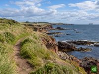
Der John Muir Way durchquert Schottland von Küste zu Küste, von Helensburgh am Firth of Clyde bis nach Dunbar an der Nordsee, wo der Naturschützer John Muir geboren wurde. Er führt über die Moorhügel oberhalb von Loch Lomond, folgt den alten Kanälen, am Antoninuswall entlang bis zum Falkirk Wheel, kommt an den Forth-Brücken vorbei, geht mitten durch Edinburgh und endet an den Stränden und Klippen von East Lothian.
John Muir Way: Karte
Die interaktive Karte zeigt den gesamten Weg mit Unterkünften, Wasserstellen und öffentlichen Verkehrsmitteln entlang der Strecke.
Tourenplaner John Muir Way
Erstelle im Tourenplaner eine Etappenroute, finde Unterkünfte entlang der Strecke und lade die GPX-Datei herunter. Starte mit einem Beispiel unten oder von vorn.
10-Day ItineraryUnten gezeigt
The John Muir Way walked coast to coast in ten days on its ten official sections, from the start plinth on Helensburgh's waterfront to John Muir's Birthplace in Dunbar, with a few overnights shifted a little along the trail so that no day is far harder than the rest. The first day climbs over Gouk Hill for the first views of Loch Lomond, drops to Balloch and carries on through Balloch Castle Country Park to stop just beyond the town. That takes some of the weight off the second day, the crossing of the Kilpatrick Hills to Strathblane, which is the highest and most remote ground of the whole route and still the longest day. From there the walking eases onto the Strathkelvin Railway Path and the Forth and Clyde Canal, over the Roman fort on Bar Hill to Auchinstarry Marina, then along the Antonine Wall over Croy Hill and past Rough Castle to the Falkirk Wheel. Beyond Falkirk the Way passes Callendar House, follows the Union Canal and the River Avon to Linlithgow Bridge and climbs Fishers' Brae above Linlithgow, so the next morning starts in Kinneil Estate and Bo'ness before the Forth shore leads past Blackness Castle and Hopetoun to the three bridges at South Queensferry. Edinburgh comes by Cramond, Corstorphine Hill, the Water of Leith and the Union Canal. The last three days run out along the East Lothian coast through Musselburgh to Port Seton, by Aberlady, Gullane and Dirleton to North Berwick, then inland by East Linton and the River Tyne and back to the sea at John Muir Country Park for the finish.
John Muir Way: Etappen
10 Tage, 216 km und 2.360 m Aufstieg. Die Etappen folgen der Beispielroute „10-Day Itinerary“. Öffne sie im Tourenplaner, um Tage zu teilen oder zusammenzulegen und Unterkünfte zu wählen.
- Etappe 118,4 km↑ 454 m · ↓ 386 m ·
6–7h mit PausenNach Balloch
Übernachtung: Westertonhill Holiday Lodges - Etappe 226,2 km↑ 490 m · ↓ 486 m ·
8–9h mit PausenBalloch Strathblane
Übernachtung: Kirkhouse Inn - Etappe 321,6 km↑ 163 m · ↓ 191 m ·
6–7h mit PausenStrathblane Auchinstarry
Übernachtung: The Boathouse Hotel Bar & Restaurant - Etappe 419,2 km↑ 258 m · ↓ 203 m ·
5–6h mit PausenAuchinstarry Falkirk
Übernachtung: Spoke'n'Boot Camping Pods - Etappe 518,9 km↑ 212 m · ↓ 218 m ·
5–6h mit PausenFalkirk Linlithgow
Übernachtung: Wester Muirhouse - Etappe 620,8 km↑ 109 m · ↓ 202 m ·
6–7h mit PausenLinlithgow South Queensferry
Übernachtung: Orocco Pier Hotel - Etappe 724,1 km↑ 305 m · ↓ 238 m ·
7–8h mit PausenSouth Queensferry Edinburgh
Übernachtung: Castle Park Guest House - Etappe 820,7 km↑ 75 m · ↓ 141 m ·
6–7h mit PausenEdinburgh Port Seton
Übernachtung: Anchorage B&B - Etappe 921,4 km↑ 85 m · ↓ 84 m ·
6–7h mit PausenPort Seton North Berwick
Übernachtung: Marine & Lawn North Berwick - Etappe 1025,1 km↑ 209 m · ↓ 200 m ·
7–8h mit PausenNorth Berwick Dunbar
Beste Reisezeit
- Beste Zeit1. Apr. – 30. Juni, 1. Sept. – 30. Sept.
- Gute Zeit1. März – 31. März, 1. Juli – 31. Aug., 1. Okt. – 31. Okt.
- Möglich, mit Vorsicht1. Nov. – 29. Feb.
Das ganze Jahr über begehbar, durchweg niedrig und selten weit von einem Ort oder einem Bahnhof entfernt. April bis Juni sind die trockensten und sonnigsten Monate, und im September wird es ruhiger, sobald die Sommerferien vorbei sind. Juli und August sind regenreicher, vor allem im Westen, und für Edinburgh bucht man im August, dem Monat der Festivals, besser früh. Von November bis Februar bleiben nur etwa sieben Stunden Tageslicht, zu wenig für die lange Überquerung der Kilpatrick Hills, und Winterstürme peitschen die Küste von East Lothian.